
 | ||
108 sandridge rd mitchells island nsw 2430
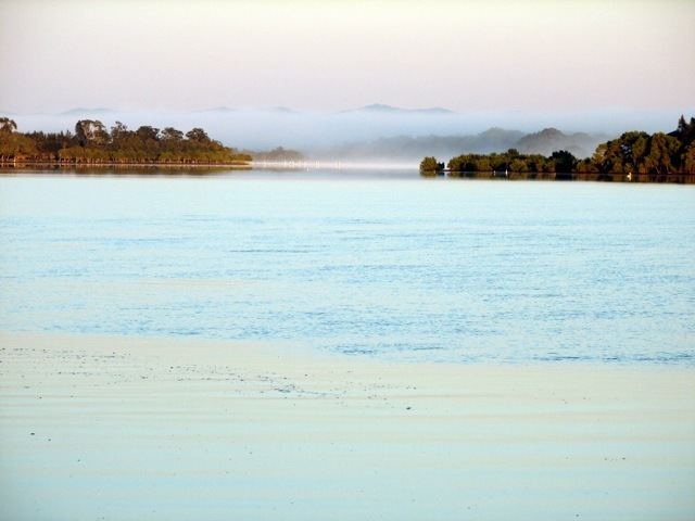
Mitchells Island is the largest of several islands in the mouth of the Manning River. It is roughly triangular in shape and has an area of approximately 130 km2 (50 sq mi). It is bordered on the north by the main channel of the Manning River, on the southwest by Scotts Creek, and on the east by the Pacific Ocean. The ocean edge extends from Old Bar in the south to Harrington to the north.
Contents
- 108 sandridge rd mitchells island nsw 2430
- Map of Mitchells Island NSW 2430 Australia
- Manning point beach mitchells island dogexplorer com au
- References
Map of Mitchells Island, NSW 2430, Australia
Mitchells Island is located at 31°53'60S 152°37'0E and varies its altitude from sea level to 151 m (495 ft). It is named after Thomas Livingstone Mitchell (1792–1855), who served as Surveyor-General for Australia. It and the adjacent Oxley Island is a shale outcrop rather than a sandy deposit.
The population of Mitchells Island is approximately 300 permanent residents. Much of the island was covered by dairy farms but today there is only one remaining farm. It is a popular holiday location and has two caravan parks and many rental homes and units.
Mitchells Island largely consists of dense rainforest, home to many native animals including koalas, echidnas, wallabies, possums, bandicoots, quolls, goannas and birds.
The housing estate 'Manning Waters' was developed in 1991 with two houses, growing to 36 homes today. The Mitchell family are the local guides, providing an information centre. The Islands famed Mitchells family home and information/manning tours centre is situated between the Islands historical St. Marks church which was built in the 1940s in the place where its large cedar log washed down river from the timber mill during floods, and the 'Best view' cemetery, on the highest point of the Island looking over the river towards the little brother mountain ranges. There is one village on the island, Manning Point, approximately 330 km (210 mi) north of Sydney. Besides the holiday rental units, it has a general store, a bowling club, the two caravan parks, a cafe, and a bait shop. The general store is also the news agent, the video rental shop, the Australia Post Office, the bottle shop, the burger and fish and chips grill, and the grocery store.
The Pacific Ocean forms the eastern border of the island. While the entire length is a sand beach, there are two accesses. The northern access is from the village of Manning Point and is reinforced to allow four-wheel drive vehicle access. The southern access is from Beach Road. This access is a narrow path over the boundary dune. Neither beach is patrolled.