
Location South East Asia Highest elevation 561 m (1,841 ft) Province West Papua | Archipelago Raja Ampat Islands Elevation 535 m Island group Raja Ampat Islands | |
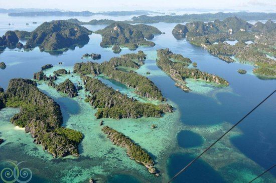 | ||
Misool raja ampat aerial video balbulol dafalen spot
Misool, formerly spelled Mysol (Dutch: Misoöl), is one of the four major islands in the Raja Ampat Islands in West Papua (formerly Irian Jaya), Indonesia. Its area is 2,034 km². The highest point is 561 m and the main towns are Waigama, located on the island's northern coast, and Lilinta.
Contents
- Misool raja ampat aerial video balbulol dafalen spot
- Map of Misool Lilinta West Misool Raja Ampat Regency West Papua Indonesia
- A place to visit misool raja ampat 2
- Fauna
- History
- References
Map of Misool, Lilinta, West Misool, Raja Ampat Regency, West Papua, Indonesia
The inhabitants speak the Biga language and Matbat language, as well as Indonesian.
Other main islands of this group off the western end of West Papua are Salawati, Batanta and Waigeo, and there are numerous smaller islands such as Kofiau.
A place to visit misool raja ampat 2
Fauna
History
Part of the Dutch colonial empire, the Netherlands East Indies.
Occupied on 1942 by the Japanese. Imperial Japanese Navy base until 1945.
References
Misool Wikipedia(Text) CC BY-SA