
Length 0.503 mi (0.810 km) Inaugurated 1922 | Inauguration 1922 | |
 | ||
Similar Miracle Mile and Downtow, Village of Merrick Park, Miami Bilt Hotel, Venetian Pool, Lowe Art Museum | ||
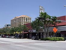
Miracle Mile is a 0.503-mile-long (0.810 km) section of Coral Way between LeJeune Road (SW 42nd Avenue) and Douglas Road (SW 37th Avenue) in the city of Coral Gables, Florida, United States. It is the main east-west road through the city's downtown central business district, consisting of many shops, financial institutions, restaurants and arts institution. The LeJeune Road end of Miracle Mile is anchored by the Coral Gables City Hall.
Contents
Map of Miracle Mile, Coral Gables, FL 33134, USA
Miracle Mile and the surrounding Downtown Coral Gables area is served indirectly by the Miami Metrorail by transferring from the Douglas Road station to the Coral Gables Trolley at the station. The trolley runs up and down Ponce de Leon Boulevard from Miracle Mile to the Metro.
History
The downtown commercial district, including Miracle Mile, was designed by George Merrick, who could boast that every business in Coral Gables was less than a two-block walk. The area was once serviced by a free trolley that ran down Ponce de Leon Boulevard, the main artery bisecting the business district. The old trolley system was replaced by the popularity of modern automobiles until a new free "trolley system" (buses with a "retro" trolly-like livery) was initiated in November 2003. Now, Coral Gables is known as a pedestrian-friendly destination.