
 | ||
Similar The Museum of Russian Art, American Swedish Institute, Mill City Museum, Lake Harriet, Foshay Tower | ||
Evolution of the minneapolis skyway system 1962 2002
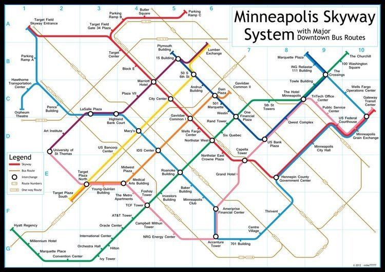
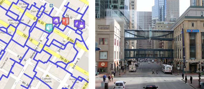
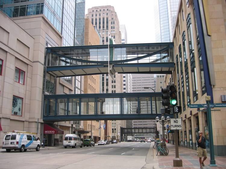
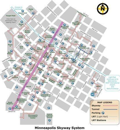
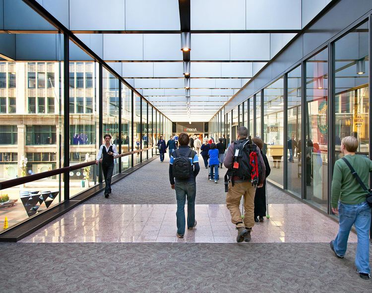
The Minneapolis Skyway System is an interlinked collection of enclosed pedestrian footbridges that connect various buildings in 69 full city blocks over 11 miles (18 km) of Downtown Minneapolis, enabling people to walk in climate-controlled comfort year-round. It is the longest continuous system in the world. The skyways are owned by individual buildings in Minneapolis, and as such they do not have uniform opening and closing times. The eight miles of skyway are comparable to the Houston tunnel system, the systems of Canadian cold-weather cities Toronto and Montreal, and Calgary's 11-mile Plus 15 (+15) Skyway system.
Contents
- Evolution of the minneapolis skyway system 1962 2002
- History and development
- Notable buildings connected
- References
The Minneapolis skyways connect the second and third floors of various office towers, hotels, banks, corporate and government offices, restaurants, and retail stores to the Nicollet Mall shopping district, the Block E Entertainment District, and the sports facilities at Target Center, Target Field and U.S. Bank Stadium. Several condominium and apartment complexes are skyway-connected as well, allowing residents to live, work, and shop downtown without having to leave the skyway system.
History and development
The city's first skyways were planned by real estate developer Leslie Park in the early 1960s. Sensing pressure from indoor shopping malls such as Southdale Center, Park wanted to create a similar environment in Downtown Minneapolis that would offer a climate-controlled space and a way for pedestrians to move from building to building. He built two skyways connecting the newly constructed Northstar Center building to the Northwestern Bank Building and the Roanoke Building. The skyway to the Northwestern Bank Building was built in 1962 and the skyway to the Roanoke Building followed the next year. The second skyway still remains in use today and is the system's oldest segment.
The system grew to 7 total segments by 1972, though many of the skyways remained disconnected from one another. The construction of the IDS Center in 1974 helped to unify the system. The building featured skyways in all four directions as well as a spacious atrium area called the Crystal Court, allowing it to act as a central hub for the entire system. In 1976, the Downtown Council produced the first formal maps and signage for the system.
In 2016, the U.S. Bank Stadium became connected to the Minneapolis skyway via a mixed-use development of office buildings and apartment complexes in Downtown East, Minneapolis