
- elevation 695 m (2,280 ft) Length 350 km Basin area 710 km² | - elevation 0 m (0 ft) Discharge 12,490 m³/s Source Fuenmiña Bridges Ponte Vella | |
 | ||
- average 340 m/s (12,007 cu ft/s) | ||
Minho ([ˈmiɲu]) or Miño ([ˈmiɲo], [ˈmiɲo]) is the longest river in Galicia, Spain, with a length of 340 kilometres (210 mi).
Contents
- Map of Minho
- GeographyEdit
- EtymologyEdit
- Legends traditions and superstitionsEdit
- RightEdit
- LeftEdit
- References
Map of Minho
The name comes from Latin minius, meaning cinnibar, lead, or vermilion, essentially, "the red river". The Minno waters vineyards and farmland, is used to produce hydroelectric power, and also delineates a section of the Spanish–Portuguese border. In ancient English maps, it appears as Minno.
The source of the Minho lies about 50 kilometres (31 mi) north of Lugo in Galicia, in a place called Pedregal of Irimia. The river passes just south of the walls of this old Roman city and flows south through canyons until the valley widens north of Ourense. The river has been harnessed in reservoirs from Portomarín to Frieira. Along its length, it has the following reservoirs: Belesar with 654 cubic hectometres (530,000 acre·ft), Peares with 182 cubic hectometres (148,000 acre·ft), Velle with 17 cubic hectometres (14,000 acre·ft), Castrelo with 60 cubic hectometres (49,000 acre·ft) and Frieira with 44 cubic hectometres (36,000 acre·ft).
About 20 kilometres (12 mi) north of Ourense at Os Peares, the Minho receives the waters of its main tributary, the Sil. Passing Ourense, there is one major dam at Frieira near the town of Ribadavia, which is famous for its Ribeiro wine (called after the name of the region). Later on, the river flows in a southwest direction until reaching the Portuguese border near Melgaço.
After 260 kilometres (160 mi) through Galicia, the Minho sets the border to Portugal for about other 80 kilometres (50 mi), mainly towards the west. The valley is a lush, green agricultural area where the land is used to produce corn, potatoes, cabbage, even kiwi fruit, or just grass, depending on the time of year, and everywhere edging the fields, rivers and gardens, wherever there is space, the vines which produce the light, slightly sparkling “Vinho Verde” and the Ribeiro wine, both peculiar to this area. The very best of these wines, Alvarinho in Portuguese or Albariño in Spanish and Galician, is produced in the area around Monção, Arbo and Melgaço.
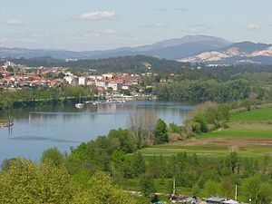
Passing the medieval towns of Melgaço and Monção, the Minho divides the Spanish Tui and Portuguese Valença do Minho, towns that guarded an important bridge for road and rail. Both towns preserve fortifications and are national monuments. The Minho reaches the Atlantic between the Galician A Guarda and the Portuguese Caminha.
GeographyEdit
The river begins in the Pedregal de Irimia of the Sierra de Meira, about 695 metres (2,280 ft) above sea level, in the municipality of Meira, northeast of the province of Lugo, where it flows underground to surface in the lagoon Fonmiña (in the municipality of A Pastoriza). This lagoon is located in the same province, is historically considered as its birthplace. The Minho flows through the Galician massif and Cantabrian Mountain range and the mountains of Leon, two of the rainiest areas of the Iberian Peninsula, being one of the main rivers of the Atlantic slope.
All its upper course has been declared a Biosphere Reserve. The Minho River runs its first 64 kilometres (40 mi) across the plateau of Lugo (Terrachá), a peneplain whose elevation ranges from 450 to 650 metres (1,480 to 2,130 ft) above the sea level.
Its main tributaries are the Sil, Neira, Avia, Barbantiño, Búbal, Arnoya rivers.
EtymologyEdit
According to E. Bascuas, "Miño", registered as Minius and Mineus, is a form belonging to the old European hydronymy, and derived from the Indoeuropean root *mei- 'walk, go'.
Legends, traditions and superstitionsEdit
The story tells the oral tradition of Galician mythological characters that were living in the basin of the Rio Minho, such as feiticeiras (witches) who lived in the same river, the Xarcos who dwelt in wells located throughout the watershed and fish-men who were amphibious with the possibility of living both on land and in water.