
Founded 1914 Congressional district At-large Website www.co.mineral.mt.us Population 4,275 (2013) Unemployment rate 7.6% (Apr 2015) | Area 3,168 km² Cities Superior, Alberton | |
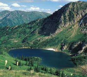 | ||
Points of interest Lookout Pass, Route of the Hiawatha Trail, Up Up Lookout, Stark Mountain, Fish Creek State Park Rivers Clark Fork River, Flat Creek, Sparks Creek, Kirchey Creek | ||
Mineral County is a county located in the U.S. state of Montana. As of the 2010 census, the population was 4,223. Its county seat is Superior.
Contents
- Map of Mineral County MT USA
- Geography
- Major highways
- Adjacent counties
- National protected area
- 2000 census
- 2010 census
- Towns
- Census designated places
- Unincorporated communities
- References
Map of Mineral County, MT, USA
Geography
According to the U.S. Census Bureau, the county has a total area of 1,223 square miles (3,170 km2), of which 1,219 square miles (3,160 km2) is land and 3.8 square miles (9.8 km2) (0.3%) is water.
Major highways
Adjacent counties
National protected area
2000 census
As of the census of 2000, there were 3,884 people, 1,584 households, and 1,067 families residing in the county. The population density was 3 people per square mile (1/km²). There were 1,961 housing units at an average density of 2 per square mile (1/km²). The racial makeup of the county was 94.57% White, 0.21% Black or African American, 1.93% Native American, 0.51% Asian, 0.03% Pacific Islander, 0.26% from other races, and 2.50% from two or more races. 1.57% of the population were Hispanic or Latino of any race. 22.5% were of German, 14.6% Irish, 9.9% English, 8.1% American and 8.0% Norwegian ancestry. Irish is the 5th most common language spoken at home.
There were 1,584 households out of which 27.70% had children under the age of 18 living with them, 57.70% were married couples living together, 6.00% had a female householder with no husband present, and 32.60% were non-families. 26.60% of all households were made up of individuals and 8.20% had someone living alone who was 65 years of age or older. The average household size was 2.41 and the average family size was 2.90.
In the county, the population was spread out with 24.30% under the age of 18, 6.40% from 18 to 24, 25.30% from 25 to 44, 29.80% from 45 to 64, and 14.20% who were 65 years of age or older. The median age was 41 years. For every 100 females there were 106.20 males. For every 100 females age 18 and over, there were 105.60 males.
The median income for a household in the county was $27,143, and the median income for a family was $32,096. Males had a median income of $26,782 versus $18,258 for females. The per capita income for the county was $15,166. About 12.80% of families and 15.80% of the population were below the poverty line, including 18.70% of those under age 18 and 8.50% of those age 65 or over.
2010 census
As of the 2010 United States Census, there were 4,223 people, 1,911 households, and 1,229 families residing in the county. The population density was 3.5 inhabitants per square mile (1.4/km2). There were 2,446 housing units at an average density of 2.0 per square mile (0.77/km2). The racial makeup of the county was 94.9% white, 1.5% American Indian, 0.7% Asian, 0.3% black or African American, 0.2% from other races, and 2.4% from two or more races. Those of Hispanic or Latino origin made up 1.9% of the population. In terms of ancestry, 30.9% were German, 16.9% were Irish, 15.4% were English, and 3.0% were American.
Of the 1,911 households, 21.9% had children under the age of 18 living with them, 52.4% were married couples living together, 7.3% had a female householder with no husband present, 35.7% were non-families, and 29.7% of all households were made up of individuals. The average household size was 2.20 and the average family size was 2.69. The median age was 49.8 years.
The median income for a household in the county was $37,256 and the median income for a family was $44,271. Males had a median income of $35,536 versus $20,370 for females. The per capita income for the county was $19,209. About 12.7% of families and 19.0% of the population were below the poverty line, including 36.0% of those under age 18 and 4.3% of those age 65 or over.