
 | ||
Weather 3°C, Wind E at 6 km/h, 95% Humidity | ||
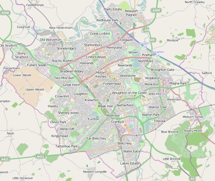
Milton Keynes is a large town in (ceremonial) Buckinghamshire. The Milton Keynes urban area or Milton Keynes Built-up Area is a designation established by the United Kingdom's Office for National Statistics. As with other urban areas, it includes settlements that regard themselves as being outside Milton Keynes.
Contents
2011 Urban sub-areas
These are the subdivisions of the Milton Keynes urban area (built-up area):
* This figure is for the remainder of Milton Keynes after deducting Bletchley, which has been part of Milton Keynes since its designation in 1967. The ONS does not give any reason for having done this.
2001 Urban sub-areas
Unlike other long established towns and cities that have historic boundaries which the ONS had been using, Milton Keynes does not have any such readily usable boundaries and consequently it was assigned a number of new urban sub-areas. Accordingly, it defined a 'Milton Keynes urban area' composed of the contiguous built environment, with 'urban sub-areas' that map to the original urban and rural districts (and sometimes to the chronological phases of urbanisation within them).
Some of the "Urban Sub-areas" largely match the boundaries of the legacy local government areas that existed before its 1967 designation as a "new town". These were:
The corresponding modern Urban Sub-areas (with links to the relevant articles) were
Newport Pagnell Rural was subdivided as development proceeded
The fragment of Winslow Rural in the designated area, Shenley Church End, was added to "Central Milton Keynes Urban Sub-area".
Note that the areas covered by these Urban Sub-area designations are larger (sometimes far larger) than the modern districts that share their names. This is particularly true of Central Milton Keynes US-a.
Calculation of population
The population of Milton Keynes's Built-up Area was 229,941 according to the 2011 census. This was an increase of almost 25% on the population recorded in the 2001 census of 184,506.