
Population 3,844 (2011 census) Postal code 2214 | Postcode(s) 2214 Milperra Revesby | |
 | ||
LGA(s) Canterbury-Bankstown Council | ||
Milperra, a suburb of local government area Canterbury-Bankstown Council, is located 24 kilometres west of the Sydney central business district in the state of New South Wales, Australia, and is a part of the South Western Sydney region.
Contents
- Map of Milperra NSW 2214 Australia
- History
- Parks
- Schools
- Commercial areas
- Transport
- Notable residents
- References
Map of Milperra NSW 2214, Australia
History
Milperra is an Aboriginal word for a gathering of people. The land at Milperra was originally owned by George Johnson Jr. After World War I, returning soldiers established poultry farms and vegetable gardens in the area. The area commonly known as Thorns Bush, became officially known as Bankstown Soldier Settlement in 1917. Many streets in the area are named after World War 1 battles and officers.
The Milperra College of Advanced Education was established in 1974, which became the Bankstown campus of the University of Western Sydney in 1989.
In September 1984, on Father's Day, members of rival motorbike gangs the Comanchero and the Bandidos had a showdown in the car park of the Milperra Viking Tavern, which is technically located in Revesby. This altercation has since been called the 'Milperra Massacre'. Six bikies and a 14-year-old girl were killed.
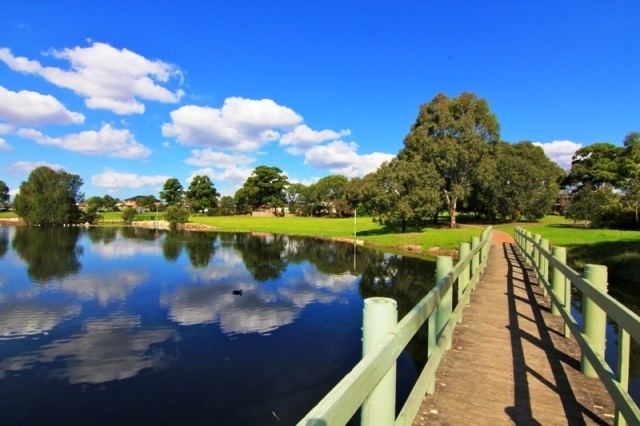
Parks
Milperra sits on the bank of the Georges River and features a number of parks and reserves along the river, including Deepwater Park, Bankstown Golf Course and Vale of Ah Reserve.
Schools
Milperra is home to the University of Western Sydney (Bankstown campus).
Milperra is also home to Mount Saint Joseph, Milperra, an all-girls high school with grades 7-12.
Milperra Public School is located on Pozieres Avenue.
Commercial areas
Milperra features a mixture of residential, commercial and industrial areas. A number of small retail strips are scattered throughout the suburb including Milperra Shopping Village on Bullecourt Avenue and Ashford Village on the corner of Bullecourt Avenue and Ashford Avenue. Another small group of shops is located on the corner of Pozieres Avenue and Amiens Avenue, opposite the public school and many commercial developments are situated along Canterbury Road.
Transport
Milperra Road is a major road on the northern border which links to Newbridge Road and Moorebank, on the western side of the Milperra Bridge, over the Georges River. The M5 South Western Motorway runs along the southern border and Henry Lawson Drive is the other major road through the area.