
Population 2,318 (2011 Census) Country Northern Ireland Post town NEWTOWNARDS Local time Wednesday 8:47 PM District Ards UK parliament constituency North Down | County County Down Sovereign state United Kingdom Postcode district BT22 Province Ulster Dialling code 028 | |
 | ||
Weather 5°C, Wind NE at 48 km/h, 90% Humidity | ||
Millisle promenade mosaics n ireland
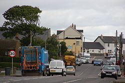
Millisle or Mill Isle is a village on the Ards Peninsula in County Down, Northern Ireland. It is about 3 miles (4.8 km) south of Donaghadee. It is situated in the townlands of Ballymacruise and Ballycopeland, the civil parish of Donaghadee and the historic barony of Ards Lower. It has been described as an "unpretentious bucket-and-spade resort of fish-and-chip shops and acres of caravan sites". It had a population of 2,318 people in the 2011 Census.
Contents
- Millisle promenade mosaics n ireland
- Map of Millisle UK
- Dji flight millisle northern ireland
- History
- 2011 Census
- 2001 Census
- Places of interest
- Sport
- People
- Unfinished Airfield at Millisle
- References
Map of Millisle, UK
Dji flight millisle northern ireland
History
As Nazism ascended in mainland Europe, the British Jewish Refugee Committee organised Kindertransport with the help of the British government. Around ten thousand unaccompanied children, aged between three and seventeen from Germany, Austria and Czechoslovakia, were permitted entry into Britain without visas. Some of these children were sent to Northern Ireland. Many were looked after by foster parents but others went to a farm on the Woburn Road, owned by the Magill family, which took refugees from May 1938 until its closure in 1948.
2011 Census
In the 2011 Census Millisle had a population of 2,318 people (991 households).
2001 Census
Millisle is classified as a village by the NI Statistics and Research Agency (NISRA) (i.e. with population between 1,000 and 2,250). On Census day (29 April 2001) there were 1,800 people living in Millisle. Of these:
For more details see: NI Neighbourhood Information Service
Places of interest
Ballycopeland Windmill, a late 18th-century tower mill in use until 1915 and still in working order. The visitor centre at the miller’s house includes an electrically operated model of the mill and a restored corn-drying kiln.
Millisle Lagoon and Beach Park has 165 yd (150 m) of golden sand and a seawater lagoon providing a safe bathing area. A jetty, slipways and paddling pool complement the lagoon area situated at the shorefront of Millisle village. The beach received one of only eight Northern Ireland Tourist Board 'Seaside Award' in 2010 for its natural beauty and cleanliness
The Northern Ireland Prison Service College is situated on a 21-acre (85,000 m2) site on the outskirts of Millisle.
The First and Last Pub which is situated in Millisle was apparently visited in 1690 by William III of England on his way south to the Battle of the Boyne, despite actually being founded in 1790 a full hundred years after the battle.
The Borstal a former family summer home turned young offender's home and is now a prison officer training centre called Lisnevin Training School.
Lisnevin School was an Industrial School, sometimes called Millisle Borstal after it moved to its location in 1931, it closed as a detention center on 7 October 2003.
Sport
Abbey Villa F.C. play association football in the Northern Amateur Football League.
People
Unfinished Airfield at Millisle
Travelling along the Moss Road (B172) from Millisle to Newtownards you pass a large strip of concrete the remnants of an airfield (known as RAF Millisle, or Killaughey or Killaghy Airfield). It was a planned airfield some 22 kilometers from Belfast, located in the North Down area of Northern Ireland. It was selected and surveyed by two RAF Officers Squadron Leader WR Fawdry and Pilot Officer Spencer.
On 17 April 1942, Stewart & Partners Ltd were awarded the project at the cost of £250,000. Construction of the airfield had already begun when the entire project was cancelled on 29 December 1943 when on 20% of the work was completed (PRONI) no reason can be found as to why the project was abandoned. The airfield was designated to become a USAAF B-29 Bomber Base. Building materials were delivered by tractor and trailer and trucks to the site. Many of the construction workers came from the Republic of Ireland. This was mainly due to the shortage of local manpower. When the Air Ministry ordered Sunday working to increase productivity, the local Presbyterians held a series of prayer meetings in a bit to keep Sunday a day of rest. The runway under construction began to show undulations in the north side but likely that was not caused by divine intervention. Construction of the runway had begun directly on top of boggy grassland with no proper foundations. Local houses and 4 local farms were vested by the Air Ministry for the use of the war effort. Explosives were used to clear the site for the construction of the new airfield. One of the houses vested was used as an office for the construction company.
In late 1943 the site was still being cleared as a house was blown only one day before construction was halted. After the war the remaining buildings on the north side of the airfield (Killaughey Road) were used by local farmers and later by small businesses. Today some of the buildings are derelict and they can still be seen but a number are used by as a small industrial development, engaged in various businesses under the collective name of Glenarley. The Women's Auxiliary Air Force (WAAF) accommodation and post office were small buildings off to the west of the airfield (Gransha Road). These were demolished after the war. Although the airfield was never completed the main runway that was built was used several times after the war. There is a mention of an Auster (airplane) making an emergency landing, and several records naming de Havilland Tiger Moths landings. The last use of the airfield was around 1970. Today the runway is on private property thus not accessible although it is possible to see it up close. A local road crosses the runway about midway. On aerial photography (ronaldv) the beginnings of the other two runways can still be recognised on the northern half of the runway. The northern half is the only part that is still at its original width (45/50yds) and its finished length is 1800 M. To the west of the remaining barracks, a platform and a small sections of taxiways can be found. Millisle holds the dubious distinction of being the only uncompleted airfield of World War II in the UK.