
OS grid reference NZ28866552 | ||
 | ||
Similar Milecastle 52, Milecastle 3, Milecastle 20, Milecastle 11, Milecastle 47 | ||
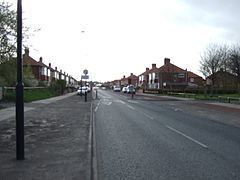
Milecastle 1 (Stott's Pow) was a milecastle of the Roman Hadrian's Wall. It was located near the (now disappeared) valley of Stott's Pow. Its remains are covered over, and are located beneath the recreation ground at Miller's Dene. Early excavations and investigations of Turret 0B were mistakenly interpreted as Milecastle 1.
Contents
Construction
Milecastle 1 was a short-axis milecastle of unknown gateway type. Short-axis milecastles were thought to have been constructed by the legio II Augusta who were based in Isca Augusta (Caerleon).
Excavations and investigations
Associated Turrets
Each milecastle on Hadrian's Wall had two associated turret structures. These turrets were positioned approximately one-third and two-thirds of a Roman mile to the west of the Milecastle, and would probably have been manned by part of the milecastle's garrison. The turrets associated with Milecastle 1 are known as Turret 1A and Turret 1B.
Turret 1A
Turret 1A was probably located very near to what is now the junction of the A187 Fossway, and Coutts Road. This is based on measurement, and no evidence of the turret has been identified. An alternative location would be a third of a Roman mile between the site of Horsely's Milcastle 1 (Turret 0B) and Milecastle 2 (location also doubtful).
Location on Ordnance Survey 1:25 000 map: 54.981990°N 1.557071°W / 54.981990; -1.557071 (Turret 1B)
Alternative location on Ordnance Survey 1:25 000 map: 54.983713°N 1.549161°W / 54.983713; -1.549161 (Turret 1B)
Turret 1B
Turret 1B was probably located just west of the junction of the A187 Fossway, and Roman Avenue. This location was suggested by FG Simpson, and is based on measurements from Milecastle 2 (the location of which is also in doubt). No evidence of the turret has been identified.
Location on Ordnance Survey 1:25 000 map: 54.981069°N 1.563253°W / 54.981069; -1.563253 (Turret 1B)