
Basin size 4,028 km (1,555 sq mi) Discharge 14.72 m³/s | Length 156 km Province Province of Castellón Bridges Santa Quiteria Bridge | |
 | ||
River mouth Mediterranean Sea0 m (0 ft) | ||
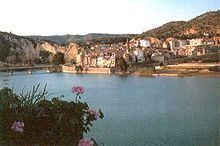
The Mijares or Millars (Spanish: Mijares, Catalan: Millars, Aragonese: Millars) is a river in Aragon and the Valencian Community, eastern Spain. It flows into the Mediterranean Sea between Almassora and Burriana. The Mijares River marks the southernmost limit of the Catalan Mediterranean System.
Map of Mijares, Castell%C3%B3n, Spain
This river originates at a height of 1,600 m in the Sierra de Gúdar, Sistema Ibérico. It is 156 km long, with a 4,028 km2 wide basin and an average flow of 14.72 m3 per second at Cirat. This river is the main source of irrigation water for agriculture in the Plana Baixa comarca.
References
Mijares (river) Wikipedia(Text) CC BY-SA