
Country Philippines Barangays Area 161.6 km² Province Zamboanga del Sur | Founded September 9, 1964 Time zone PST (UTC+8) Local time Wednesday 3:48 AM | |
 | ||
Region Zamboanga Peninsula (Region IX) District 1st district of Zamboanga del Sur Weather 19°C, Wind NW at 3 km/h, 92% Humidity | ||
Tinubdan sa kinabuhi sa midsalip zamboanga del sur
Midsalip is a fourth class municipality in the province of Zamboanga del Sur, Philippines. According to the 2015 census, it has a population of 32,075 people.
Contents
- Tinubdan sa kinabuhi sa midsalip zamboanga del sur
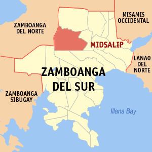
- Map of Midsalip Zamboanga del Sur Philippines
- History
- Barangays
- References
Map of Midsalip, Zamboanga del Sur, Philippines
History
The town's name is from a Subanen word,"Migsalip" which means "to collect" or "accumulate".
Midsalip was formed as a municipality out of 21 barrios of the Municipality of Ramon Magsaysay and 6 barrios of the Municipality of Dumingag on September 9, 1964, by virtue of Executive Order Number 94 signed by President Diosdado Macapagal. This didn’t last long, however, as it was dissolved on February 26, 1966, due to a Supreme Court decision regarding the legality of the funds disbursed by the municipal treasurer. As a result, Midsalip was reverted to barrio status. It wasn’t until May 8, 1967, when the Republic Act No. 4871 was passed when Midsalip became a regular municipality again.
Barangays
Midsalip is politically subdivided into 33 barangays.