
Length 3.5 mi (5.6 km) Season Year round Right of way Lehigh Valley Railroad Uses Running, Hiking, Cycling | Trail difficulty Easy Surface Asphalt Trailheads Metuchen, Woodbridge | |
 | ||
Location Middlesex County, New Jersey | ||
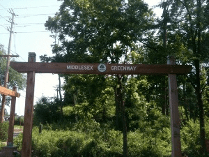
The Middlesex Greenway is a 3.5 miles (5.6 km) rail trail in New Jersey between Metuchen and Woodbridge. It makes up a portion of the East Coast Greenway.
Contents
Map of Middlesex Greenway, New Jersey, USA
The trail begins at Crows Mill Road near William Street in the Fords/Keasbey section of Woodbridge and terminates in Metuchen at Middlesex Avenue, with 12 entry points. Construction costs were $5 million. Expansion to Perth Amboy and South Plainfield has also been proposed.
History
The trail's roadbed originates from the Easton & Amboy Railroad created by the Lehigh Valley Railroad in 1875 to transport anthracite coal to a transfer dock in Perth Amboy for subsequent delivery to New York City. The line was consolidated into Conrail with other bankrupt railroads in 1976, and abandoned in 1991.
Using open space funds, Middlesex County purchased the roadbed from Conrail in December 2002 for approximately $50,000. In 2004 Edison elected officials challenged NJDOT's plan to replace an original railroad trestle with a 140-foot long tunnel-like structure to carry the trail under US Route 1. The proposed culvert would have reduced the trail's capacity to a 14-foot wide by 10-foot high passageway, potentially preventing mounted police from traversing the highway. NJDOT eventually agreed to construct a pedestrian bridge in lieu of the culvert.
In 2005 Middlesex County acquired 2.68 acres of land adjacent to the trail to build a park along a portion of the abandoned roadbed at a cost of $1.25 million Middlesex County and $100,000 from Metuchen.