
- elevation 1,224 ft (373 m) | Basin area 8,858 km² | |
 | ||
- average 6,532 cu ft/s (185 m/s) | ||
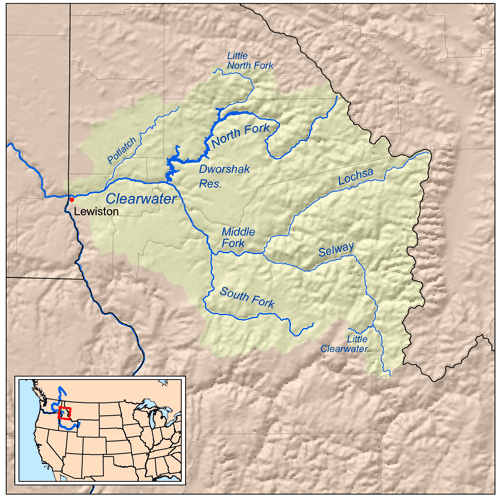
The Middle Fork Clearwater River is a short, but high volume river in northern Idaho and is the major source of the Clearwater River, a tributary of the Snake River. The Middle Fork flows west for 23 miles (37 km) from the confluence of the Selway River and Lochsa River at Lowell, to the town of Kooskia where it joins with the South Fork Clearwater River to create the Clearwater River. The Middle Fork's entire length is within Idaho County, although a small portion of its watershed extends into Clearwater County.
Map of Middle Fork Clearwater River, Idaho, USA
The Middle Fork, along with the Selway and Lochsa Rivers, was among the original eight rivers designated as part of the National Wild and Scenic Rivers System. It is a major migration route for Pacific chinook salmon that spawn in the Selway River. Although the Middle Fork flows through a tight canyon, it is characterized by gentle Class I and II rapids suitable for floating, especially in late summer after the peak snow melt has decreased.
U.S. Route 12 follows the entire length of the river.