
 | ||
Mhaismal, is a beautiful hill station located in the Aurangabad District of Maharashtra. The Hill Station is situated at an altitude of 1067 meters, is about 12 kilometers from Khuldabad and is about 40 Kilometers from Aurangabad City. On the way there are Ellora Caves, Grishneshwar Temple and Devgiri Fort.
Contents
- Map of Mhaismal Maharashtra 431102
- Mhaismal hill station aurangabad i time lapse
- Climate
- Nearby Holy Places
- other places nearby
- How to reach
- References
Map of Mhaismal, Maharashtra 431102
Mhaismal, originally called as Maheshmal for the Maheshmal Village within the place.
Mhaismal attracts visitors during monsoons when it is covered in greenery.
Mhaismal hill station aurangabad i time lapse
Climate
Pleasant Climate - Temperature 10 °C to 32 °C
Nearby Holy Places
Amne Samne ki Dargah
Goddess Girija Temple
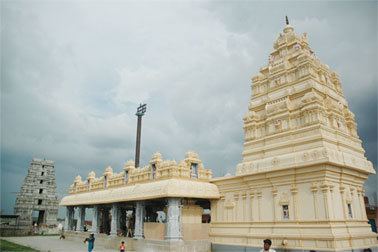
Balaji Temple
Srimad Srirangam Andavan Mutt and Veda Patashala and Varahaswamy Temple, Maishmal
Ghrishneshwar Temple
Hanuman Temple Kultabad
other places nearby
Aurangzeb Tomb
How to reach
By Air :-
Nearest Airport to Mhaismal is the Aurangabad Airport.
By Road :-
Drive of 1 hour by car from main city.