
 | ||
The metropolitan area of Seattle in the U.S. state of Washington contains one of the smallest freeway systems in the U.S. based on population.
Contents
- Interstate 5
- Interstate 90
- Interstate 405
- SR 520
- SR 167
- SR 99SR 599
- West Seattle Freeway
- Other freeways
- Interstate 605
- Bay Freeway
- Northwest Expressway
- RH Thomson Expressway
- The Eastside Expressway
- References
There are 21 different freeways and highways the make up the Seattle freeway system. They are: Interstate 5, Interstate 405, Interstate 90, Interstate 705, US 2, SR 3, SR 16, SR 18, the Alaskan Way Viaduct/SR 99, SR 167, SR 303/Waaga Way, SR 410, SR 509, SR 512, SR 518, SR 520, SR 525, SR 526, SR 599, the Port of Seattle owned Airport Expressway, and the City of Seattle owned West Seattle Freeway. Interstate 5 is the major North-South route through the region. Interstate 5 is four or five lanes for most of its way through the metro area. The freeway connects the metro area to California, Oregon, and British Columbia.
The freeway system uses ramp meters to help keep traffic moving. WSDOT uses variable message signs to let travelers know if there is an accident, to tell drivers how long their drive will be to certain areas, and for Amber Alerts. Recently, WSDOT installed variable speed signs along SR 520 and I-90 between I-5 and I-405, and along I-5 between the West Seattle Freeway and SR 520. There are also HOV lanes to move buses and carpools faster on many freeways and arterials. The HOV lanes on I-405 allow general purpose traffic to use them after 7pm (till about 5am), and the lanes on SR 167 are actually HOT lanes (carpools may use the lanes free; solo drivers can use the lanes for a variable fee). There are 225 lane miles of HOV lanes built and another 100 unbuilt. Freeway improvements are paid for by two gas taxes, 2003 Gas Tax and 2005 Gas Tax.
Interstate 5
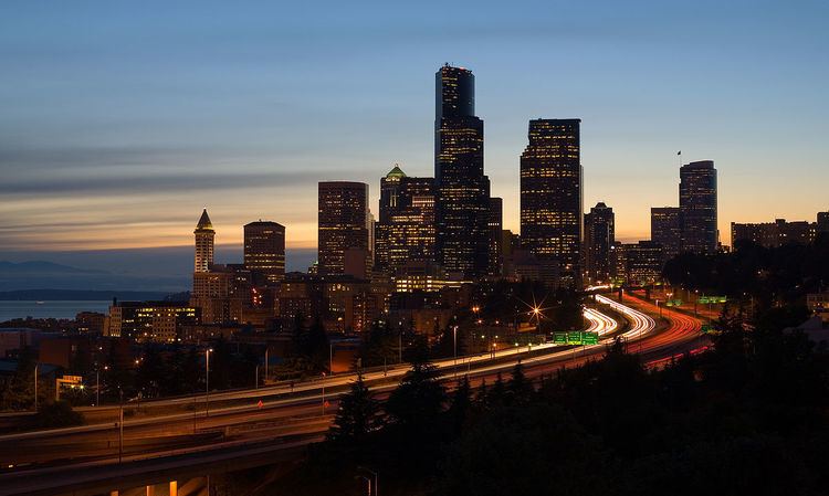
This is Seattle's largest and widest freeway. Traffic back-ups going into Seattle from the north and south are very common during the morning and evening rush hours.
The freeway runs just east of Downtown Tacoma as it goes through the metro area. After going through Federal Way and the west side of Kent it passes by a major shopping mall, Southcenter in Tukwila, where it connects with the south terminus of Interstate 405. Then the freeway continues and passes by Seatac International Airport in the inner southern suburbs of Seattle and passes very close to Boeing Field (also known as King County International Airport). As the freeway heads towards Downtown Seattle, reversible lanes, or express lanes, branch off the mainline and continue north through the city. The express lanes carry southbound traffic in the morning and northbound traffic in the afternoon. The Express Lanes merge with the main line in the Northgate area of North Seattle. After that, I-5 continues north through the cities of Shoreline, Mountlake Terrace, and Lynnwood. In Lynnwood it merges with Interstate 405 again. It continues north to the last large city in Seattle Metro area, Everett. It was built in South Tacoma between 1955 and 1957, North Tacoma to Kent between 1959 and 1961, between Kent and downtown Seattle in 1966, from downtown Seattle to Roanoke Street in 1964, from Roanoke Street to Lake City Way/SR 522 in 1960, and north of there to Everett in 1964.
Interstate 90
This freeway goes east out of Seattle, eventually terminating in Boston. The freeway was originally built in 1940 from Rainier Avenue to Issaquah. It passes through the Eastside's largest city, Bellevue, and skirts the north side of Factoria Mall in Bellevue, where it interchanges with the north-south Interstate 405. Then the freeway continues east and passes through Issaquah, Snoqualmie, and North Bend before climbing into the Cascade Mountains. The freeway originally consisted of four lanes, and crossed the Lacey V. Murrow Floating Bridge. In the early 1950s, an interchange was built at Rainier Avenue and the highway extended 1 mile closer to Seattle's city centre along "Corwin Place". In the early 1960s, traffic congestion forced the Department of Highways to institute a tidal flow system, in which three lanes, controlled by overhead signals went into Seattle in the morning, and the toward Bellevue in the afternoon. In 1968, improvements to the east of Mercer Island were made; the highway was widened to up to 6 lanes in each direction and the interchange with I-405 was upgraded from a cloverleaf to a fully directional interchange. Litigation kept the 7-mile section between Bellevue and Interstate 5 from being upgraded until the 1980s, at which time a new bridge from the Eastside to Mercer Island was built and the dangerous "bulge" was removed from the Lacey V. Murrow Floating Bridge. In 1990, the renovations/widening of the freeway were completed, including the new Homer M. Hadley Memorial Bridge over Lake Washington to carry westbound traffic and the HOV/reversible lanes, or express lanes, from Bellevue to Seattle, with general-purpose traffic allowed to use the reversible lanes in between Mercer Island and Seattle. The express lanes carry westbound traffic in the morning and eastbound traffic in the afternoon. Further improvements are now being made to put HOV lanes in both outer roadways to ready the center roadway for Sound Transit's Link light rail.
Interstate 405
Interstate 405 begins in Tukwila at I-5, SR 518, and Westfield Southcenter, and continues east through Renton and then turns north and runs through Bellevue, Kirkland, and Bothell, before turning northwest and crossing I-5 in Lynnwood (near Alderwood Mall), where it becomes SR 525, a freeway for its first few miles. I-405 was built in stages between 1955 and 1968, with a major upgrade north of Bellevue to Bothell in 1972. HOV lanes were added in the 1980s and 1990s, the interchange between I-405 and SR 520 was upgraded in the early 1990s, and new ramps have been added in downtown Bellevue in recent years to supplement the original interchange at NE 8th Street.
SR 520
SR 520 begins in Seattle at I-5 and continues east across Lake Washington on the Evergreen Point Bridge through Bellevue, interchanges with I-405, then turns northeast, passes the main Microsoft campus (which funded an overpass at NE 36th St and an interchange at NE 40th to supplement the existing interchange at NE 51st St), and terminates in Redmond at SR 202. The section between I-5 and Bellevue Way was opened in 1963, with the interchange at I-405 built in 1966. It was further extended to it current terminus between 1973 and 1982. The Washington State Department of Transportation is currently widening the freeway on the Eastside, modifying interchanges, and moving the HOV lanes to the inside of the roadway.
SR 167
SR 167, also known as the Valley Freeway, begins in Renton at I-405 and continues south through Kent, Auburn, where it interchanges with SR 410, Pacific, and Algona, then interchanges with SR 410, and currently terminates at SR 161. The Valley Freeway was built in stages between 1964 and 1977, with a major upgrade of its southern end in 1986. The Washington State Department of Transportation is currently planning to extend the freeway to Tacoma. SR 167 has HOV lanes between I-405 and SR 18 which also allow single-passenger vehicles to use them for a variable fee, also known as HOT lanes.
SR 99/SR 599
SR 99/SR 599, parts of which are also known as West Marginal Way, begins in Tukwila at I-5 and continues north to the First Avenue South Bridge, where it interchanges with SR 509, then continues as a surface street (East Marginal Way) for a few miles, then becomes the Alaskan Way Viaduct, which is in the process of being upgraded and moved into a deep-bored tunnel. After this, SR 99 passes through a cut-and-cover tunnel and emerges as Aurora Avenue, a divided expressway (partial control of access with interchanges) until Green Lake, where it becomes a surface street again. SR 599 was built in 1968, the freeway portion of SR 99 was built in 1956 as was the First Avenue South Bridge (a second structure was built next to the first in the early 1990s), and the Alaskan Way Viaduct was open in 1952, with an extension open in 1959. North of that, Aurora Avenue was built in 1932, including the cantilever/truss George Washington Memorial Bridge.
West Seattle Freeway
The West Seattle Freeway begins in Seattle at I-5 and continues west, where it interchanges with SR 99 and terminates at a signal at Fauntleroy Way. The West Seattle Freeway was built in 1941, and the high-level bridge opened in 1984 and the roadway was widened in 2012 between I-5 and SR 99.
Other freeways
Most of the other freeways in the Seattle area are two lanes in each direction and generally travel in a north/south direction, with the exceptions of US 2, SR 410, SR 512, SR 518, SR 526, and Waaga Way. SR 16 is signed east-west but it travels mostly north-south.
Interstate 605
There have been on and off proposals to bypass Seattle to the east by another freeway using SR 18, going through the Snoqualmie Valley, and connecting with US 2 near Monroe.
Bay Freeway
This cancelled freeway would have connected I-5 with SR 99 generally along Mercer Street. Currently, the City of Seattle is widening Mercer Street to 6 lanes with a landscaped median, restoring it to two-way operation for the first time since 1968.
Northwest Expressway
This freeway would have connected SR 99 and gone north through Interbay and Ballard. A portion of this expressway was constructed in between Dravus Street and Leary Way in Ballard.
R.H. Thomson Expressway
This freeway would have been an eastern bypass of I-5 inside Seattle and interchanged with I-5/I-405 in Lynnwood, SR 520, and Interstate 90, eventually reconnecting with I-5 near the Boeing Access Road. The only part of this expressway constructed were the "ramps to nowhere" at SR 520 in the Arboretum, ramps which are due to be removed when WSDOT replaces the Evergreen Point Bridge and approaches.
The Eastside Expressway
The Eastside Expressway project was first floated in 1951 and funded by the state legislature via a toll act in 1955. Everyone who used the road would want to reach downtown, road planners forecasted. The road, therefore, must be routed directly through heavily populated areas and the central business district in order to entice drivers and to generate the necessary tolls to make it cost-efficient. It was not actually built, but absorbed into the I-5 proposal, giving the state of Washington a head-start in the nationwide race for freeway funding in the wake of the 1956 National System of Interstate and Defense Highways Act.