
Postal code 821 00 Elevation 120 m Area code 22710 | Time zone EET (UTC+2) Vehicle registration ΧΙ Local time Sunday 9:10 PM | |
 | ||
Weather 14°C, Wind SW at 10 km/h, 80% Humidity | ||
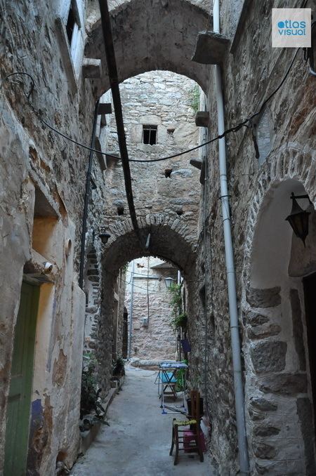
Mesta is a Greek traditional village in Chios. It belongs to Mastic Villages a group of villages in South Chios where the main activity is the agriculture of mastic. The mastic villages have added in representative List of the Intangible Cultural Heritage of Humanity of UNESCO. Mesta is characterised by particular architecture since it is a village-castle with perfectly preserved medieval architecture. Mesta is located 35 km south west of Chios (town), 4 km away from coast. It is built at a height of 120m and it belongs to Chios municipality and Mastichochoria municipal unit. It is also a community that comprises the village Limenas where the port of south west Chios is located.
Contents
Map of Mesta 821 02, Greece
History
The village was probably built in the 12th century during Byzantine era. The architecture of settlement with the narrow streets and the perimetric fortification served to repel the pirate raids. The street plan of the village is pentagonical and the many narrow roads inside the fortification give the impression of a labyrinth. The fortification reinforced during Genova era in Chios, between 1346 and 1566. In 1794 the church of the Older Taxiarchi that is located in the centre of the village was built. A lot of villagers of Mesta died and other captured during Chios massacre. Some of them were released after a while because the mastic agriculture was important for Ottomans.