
Area code(s) +55 18 | Time zone UTC-3 (UTC-3) Area 16,768 km² | |
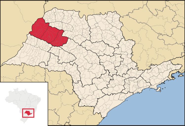 | ||
The Mesoregion of Araçatuba is one of the 15 mesoregions of the São Paulo state, Brazil. It is located at the northwest portion of the state, and has an area of 16,768.1 km².
Contents
The population of the mesoregion is 695,801 inhabitants (IBGE/2010), spread over 36 municipalities.
Municipalities
All data from IBGE/2010
Microregion of Andradina
Andradina, Castilho, Guaraçaí, Ilha Solteira, Itapura, Mirandópolis, Murutinga do Sul, Nova Independência, Pereira Barreto, Sud Mennucci, Suzanápolis
Microregion of Araçatuba
Araçatuba, Bento de Abreu, Guararapes, Lavínia, Rubiácea, Santo Antônio do Aracanguá, Valparaíso
Microregion of Birigüi
Alto Alegre, Avanhandava, Barbosa, Bilac, Birigüi, Braúna, Brejo Alegre, Buritama, Clementina, Coroados, Gabriel Monteiro, Glicério, Lourdes, Luiziânia, Penápolis, Piacatu, Santópolis do Aguapeí, Turiúba
References
Mesoregion of Araçatuba Wikipedia(Text) CC BY-SA