
Population 1,977 (2011) Meringandan West Meringandan | Postcode(s) 4352 State electorate(s) Nanango Postal code 4352 | |
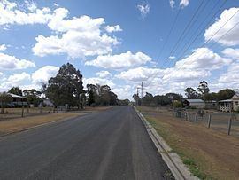 | ||
Meringandan West is a locality in the Toowoomba Region local government area on the Darling Downs in southern Queensland, Australia. At the 2011 Australian Census Gowrie Little Plain and several other nearby localities recorded a population of 1,977. The majority of the eastern boundary is aligned with Meringandan Creek
Contents
Map of Meringandan West QLD 4352, Australia
Mount Muniganeen is in the north of Meringandan West and rises to heights greater than 600 m above sea level. Central parts of the area have been developed into a residential estate. Meringandan cemetery is located in Peters Road. Meringandan West was part of a local planning scheme developed and adopted by the Toowoomba Region Council in August 2013.
Facilities
There are several scattered parks. The most popular park is Lilly Vale Oval, which has a sporting field (cricket pitch), which also, probably, operates as a flood basic, a playground, a picnic table, and a community shed, as well as a BBQ for public use. Next to this park, is a shed, from which operates the local rural fire brigade. Lilly Vale Oval, was once used for an annual rodeo hosted by the P&C of Meringandan State School. The P&C also used to run Christmas Carols in the park, but they were also cancelled for lack of funding. Small church groups still used the park for annual carols nights. In the east of Meringandan West, there is a small cemetery. Meringandan State School which offers grades P-6, is on the border between Meringandan, and Meringandan West.