
 | ||
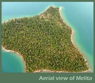
Melita Island is a 64-acre (260,000 m2) island in Flathead Lake, the largest freshwater lake in Montana. It is part of the Flathead Indian Reservation.
Contents
Map of Melita Island, Montana 59910, USA
GeographyEdit
Melita Island is a 64-acre (260,000 m2) island on Flathead Lake, located about one-half mile off the west lakeshore. At its highest point Melita is 80 feet (24 m) above water level. The closest access is from Walstad Landing (one and a half miles), a state-maintained landing off Highway 93, approximately 15 minutes north of Polson. The island is owned by the Boy Scouts of America, and is used as a summer camp and for other activities.
References
Melita Island Wikipedia(Text) CC BY-SA