
OS grid reference SX5592 Post town OKEHAMPTON Local time Saturday 9:37 AM | Sovereign state United Kingdom Postcode district EX20 Dialling code 01837 | |
 | ||
Weather 9°C, Wind W at 31 km/h, 99% Humidity | ||
Meldon is a hamlet in West Devon, on the edge of Dartmoor in Devon, England. It is 4 km south-west of Okehampton. Its main features are the Meldon Quarry and Meldon Reservoir.
Contents
Map of Meldon, Okehampton, UK
Quarries
Granite is still extracted from Meldon Quarry. The now disused Meldon Aplite Quarry has been designated as a Site of Special Scientific Interest because of its exposures of aplite and other rocks.
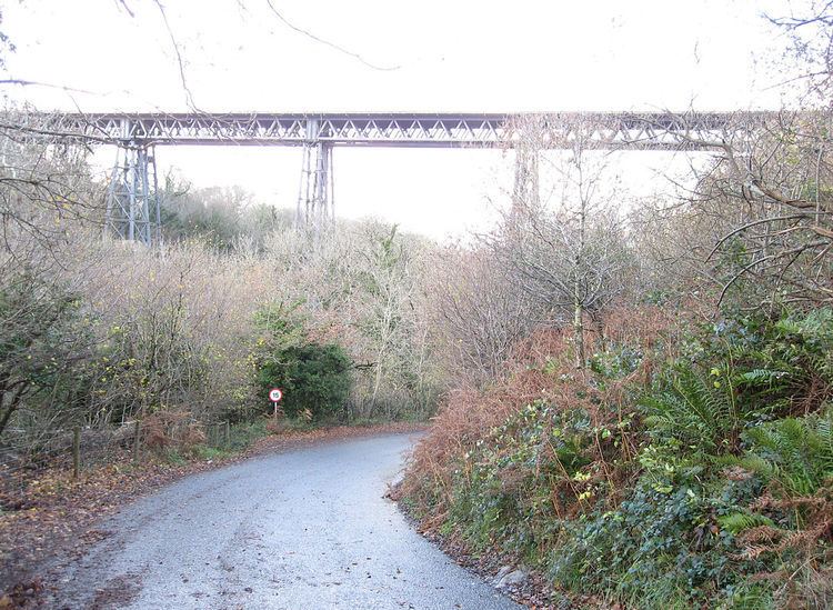
The Dartmoor Railway terminates at Meldon Quarry; the former continuation of the line to Tavistock and Plymouth continues as a cycle path. The former railway line crosses the West Okement River on the Meldon Viaduct just before reaching the quarry from the west.
Reservoir
The reservoir was formed by damming the West Okement River. It is about 1.2 km long and 300 metres wide, and extends from the West Okement valley into a small side valley.
Firing range
Immediately to the south-east is the area of the Okehampton military firing range, which is sometimes closed to the public. At other times, a footpath along the west side of the reservoir can be used to access the open moor.
Civil parish
In 1850, the civil parish of Oakhampton, or Okehampton, consisted of 9,552 acres (38.66 km2) of land, which encompassed several villages including Meldon. The hamlet is now part of the civil parish of Okehampton Hamlets.