
Department Bas-Rhin Canton Obernai Area 12.82 km² | Intercommunality Pays de Sainte-Odile Local time Saturday 5:45 AM | |
 | ||
Weather 9°C, Wind SW at 26 km/h, 69% Humidity | ||
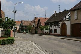
Meistratzheim is a commune in the Bas-Rhin department in Alsace in north-eastern France.
Contents
Map of 67210 Meistratzheim, France
History
Located near a Celtic-Romanic route connecting Belfort with Brumath, the village has been occupied since the Neolithic. the village is mentioned for the first time in a parchment dating from 742 where it says that the convent of Wissembourg had possessions in Maistersheim.
Initially the village belonged to the Count of Nordgau and from 742 to 1030 to different abbeys. The fief was then acquired by the diocese of Strasbourg and later by the Landsberg family, who held it up to the French Revolution.
During the seventeenth century the village was pillaged by passing Imperial, Swedish, Lorraine and French troops. Famine came because of rigorous winters and poor harvests.
Points of interest
The catholic church, Saint André, was built from 1911 to 1919, consecrated in 1922 and is at 75 m the highest in Bas-Rhin outside of Strasbourg.
Education
The Classe de Japonais en Alsace (アルザス補習授業校 Aruzasu Hoshū Jugyō Kō), a part-time Japanese supplementary school, is held in the A.P.E.J.A. in Meistratzheim.