
Elevation 650 m (2,130 ft) Area 3 km² | Founded 17th century Time zone GMT +4 Local time Saturday 4:41 AM | |
 | ||
Weather 5°C, Wind NW at 6 km/h, 63% Humidity | ||
Meghri (Armenian: Մեղրի) is a town in southern Armenia, located in the Syunik Province, near the border with Iran. The town's economy is based on the food industry, and contains a bread-baking factory, canneries and a winery. Meghri is the only location in Armenia that produces pomegranate. Meghri has a significantly milder climate than the rest of the cities in Armenia, and produces fruits not found in other parts of the country. As of the 2011 census, the population of the town is 4,580, down from 4,805 reported at the 2001 census.
Contents
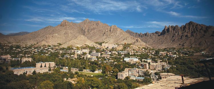
Map of Meghri, Armenia
History
In 1810, young British army officer William Monteith visited the region as part of his service with the British embassy to Persia. His 1856 memoirs paint a vivid picture of the Meghri valley which he describes as a romantic glen that he rates as one of the most beautiful in Persia, or indeed in any country. He notes that in former times [it] has evidently been densely peopled for churches, abandoned but still perfect, are thickly scattered on the slopes of the mountains, which here rise to a height on the western side of 8000 to 10,000 feet, covered with forests. The trees are of no great size, and much interspersed with apple, pear, and walnut, probably the remains of former gardens, or produced by seeds carried by the birds and wind into the once cultivated land.
He describes the settlement of Megri itself as being divided into two sections, each about half a mile from the river Araz, and separated by "small enclosed gardens, surrounded by vines". At the time, Russians controlled the larger village on the north side; the Persians occupied Little Megeri. The Araz he describes as being here a rapid foaming torrent, fordable only in one place, about a mile and a half farther up the river.
Geography
Vicinity of the town are designated as Prime Butterfly Area, having number of rare and endangered species of butterflies, such as Gegenes nostradamus, Papilio alexanor, Cupido argiades, Polyommatus damonides, and others.
Climate
The climate here is classified as BSk by the Köppen-Geiger system.
Demographics
Meghri's population stood at 272 in 1831, 927 in 1897, 1,161 in 1926, 3,095 in 1959, 4,180 in 1980, 4,805 in 2001 and 4,580 in 2010.
Politics and economy
A nearby Russian military base houses around 2,000 soldiers, who along with Armenian soldiers guard the border with Iran. The Iran-Armenia Natural Gas Pipeline passes through the city. In early 2007, it was reported that the governments of Armenia, Russia, and Iran are planning to build an oil refinery for gasoline export to Iran. This US$1.7 billion project would be led by Gazprom whose Armenian subsidiary is already the country's main energy supplier though in 2016 a new agreement opened up the possibility of having Meghri area's domestic gas supply (around 5000 households) to be provided by Iranian company Sanergy. In 2014, plans for the construction of an Iranian-funded hydro-electric power station on the Arax River were announced.