Population 14,843 (2011 census) Postcode(s) 3048 Postal code 3048 | Established 1980s Area 4.6 km² | |
 | ||
Location 18 km (11 mi) from Melbourne | ||
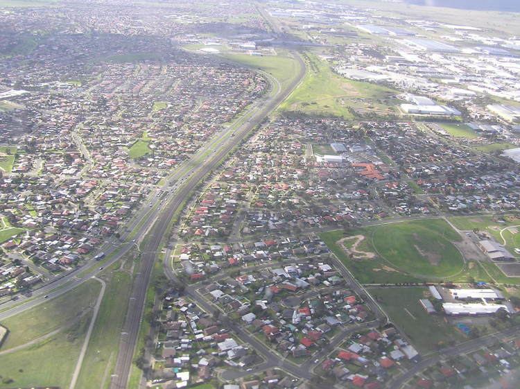
Meadow Heights is a suburb of Melbourne, Victoria, Australia, 18 km north of Melbourne's Central Business District. Its local government area is the City of Hume. At the 2011 Census, Meadow Heights had a population of 14,843.
Contents
- Map of Meadow Heights VIC 3048 Australia
- History
- Transport
- Education
- Shopping and attractions
- Demographics
- References
Map of Meadow Heights VIC 3048, Australia
History
Prior to Meadows Heights the area was officially known as Coolaroo.
Meadow Heights underwent a property boom in the late 1980s and early 1990s, as demand for new houses rose, forcing prospective buyers into the outer suburban area. Meadow Heights Post Office opened on 6 March 1995.
In recent years, developers have focused their efforts on suburbs to the north, with very few new housing projects being completed since 2000.
Transport
Bordered on the east by Pascoe Vale Road, parkland on the west, Barry Road on the south and Somerton Road to the north, Meadow Heights is served by three bus routes. The 541,542 and 540.
Coolaroo Station is the nearest railway station to Meadow Heights. The area is also served extensively by local taxi companies.
Education
Shopping and attractions
Meadow Heights offers several places of interest, with the nearest cinema complex located to the south, in Broadmeadows. There are several youth centres for social activities and there is a soccer team in the area.
There are around four milk bars; on Bicentennial Crescent and Magnolia Boulevard in the north, Taggerty Crescent in the centre, and one on El Dorado Crescent to the south.
The main shopping centre is Centro Meadow Heights, which is located on Paringa Boulevard. It features a SUPA IGA Supermarket and over 25 specialty shops.
There is also a mosque in Meadow Heights, near the shopping centre.
A community centre and a skate bowl are located in the Buchan Street Reserve.
Meadow Heights has parks all throughout the suburb, the most largest of which is the Broadmeadows Valley Park, which starts from Meadow Heights right down to Jacana, with a bike trail alongside. The park has soccer fields and playgrounds near Barry Road and Magnolia Boulevard, providing barbecue and picnic areas for residents. Shankland Wetlands has a variety of introduced and native birds. The wetlands is located south of Meadow Heights, at the end of Barry Road.
Demographics
The most common ancestries in Meadow Heights were Turkish 23.2%, Australian 10.1%, English 8.9%, Lebanese 6.8% and Iraqi 5.0%. 49.6% of people were born in Australia. The most common countries of birth were Turkey 12.8%, Iraq 8.8%, Lebanon 3.4%, Vietnam 2.9% and New Zealand 1.3%. 24.9% of people only spoke English at home. Other languages spoken at home included Turkish 26.3%, Arabic 15.5%, Vietnamese 5.0%, Assyrian Neo-Aramaic 4.8% and Chaldean Neo-Aramaic 3.5%. The most common responses for religion in Meadow Heights (State Suburbs) were Islam 42.1%, Catholic 26.5%, No Religion 6.7%, Anglican 3.6% and Eastern Orthodox 3.3%.
