
- land 1.53 sq mi (4 km) - summer (DST) CDT (UTC-5) Area code 618 Population 369 (2013) | - water 0.00 sq mi (0 km) Area 3.963 km² Local time Thursday 8:36 AM | |
 | ||
Weather 0°C, Wind SE at 8 km/h, 70% Humidity | ||
McClure is a village in McClure Precinct, Alexander County, Illinois, United States. It was incorporated in 2004 and had a population of 402 at the 2010 census.
Contents
Map of McClure, IL, USA
McClure is part of the Cape Girardeau–Jackson Metropolitan Statistical Area.
Geography
According to the 2010 census, McClure has a total area of 1.53 square miles (3.96 km2), all land.
History
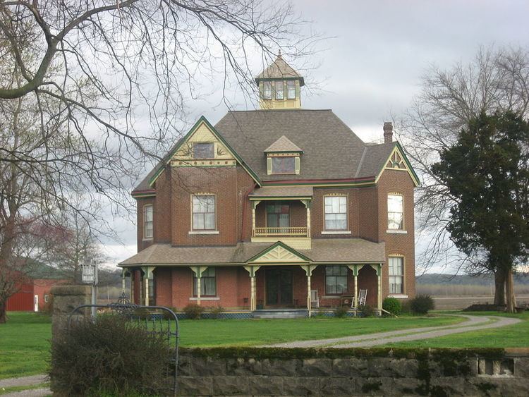
The community of McClure was established prior to 1836, the year its post office opened, and was originally known as Clear Creek Landing or Clear Creek. The community's name was changed to Wheatland in 1887 due to the large wheat fields in the region. Thomas J. McClure, for whose family the village was eventually named, moved to the village in 1842; he and his wife Caroline became prominent local farmers and raised seven children. Their son J. T. became the village postmaster, and he had the post office's name changed to McClure in 1895 to avoid confusion with the Wheaton, Illinois post office. By the 1930s, the village had two train stations, a sizable business district, and a population of roughly 400. The village has since declined and now has relatively few businesses.
The McClure family's house has been listed on the National Register of Historic Places.