
Country United States FIPS code 45-43585 Elevation 2.4 m Population 520 (2013) Area code 843 | Time zone EST (UTC-5) GNIS feature ID 1252622 Zip code 29458 Local time Thursday 9:23 AM | |
 | ||
Weather 1°C, Wind N at 8 km/h, 53% Humidity Area 6.216 km² (5.698 km² Land / 26 ha Water) | ||
McClellanville is a small fishing town in Charleston County, South Carolina, United States. The population was 499 at the 2010 census. It is situated on the Atlantic coast, on land surrounded by Francis Marion National Forest, and has traditionally derived its livelihood from the sea and coastal marshes by fishing, shrimping and oystering. McClellanville is part of the Charleston-North Charleston-Summerville metropolitan area and the Charleston-North Charleston Urbanized Area.
Contents
- Map of McClellanville SC 29458 USA
- History
- Geography
- Demographics
- Government
- Mayor
- Council members
- Education
- Notable person
- References
Map of McClellanville, SC 29458, USA
History
McClellanville village began in the late 1860s when local plantation owners A.J. McClellan and R.T. Morrison sold lots in the vicinity of Jeremy Creek to planters of the Santee Delta, who sought relief from summer fevers. The first store opened soon after the Civil War, and the village became the social and economic center for a wide area that produced timber, rice, cotton, naval stores, and seafoods. Incorporated in 1926, McClellanville became, and remains, best known for its shrimping fleet and seafood industries.
In 1989 the town was devastated by the full brunt of Hurricane Hugo which destroyed homes, downed century-old oaks, deposited shrimp boats in front yards, and otherwise altered much of the picturesque character of this historic fishing village. The stronger north side of the eyewall passed directly over the village while a Category 4 hurricane. Residents taking refuge in the local high school, a designated storm shelter, were surprised by a storm surge which threatened to drown the refugees. Helping one another in complete darkness, they managed to crawl into a space above the false ceilings of the building and, fortunately, none were lost.
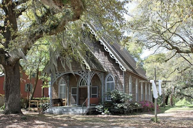
The Bethel African Methodist Episcopal Church, Cape Romain Lighthouses, Fairfield Plantation, Hampton Plantation, Harrietta Plantation, McClellanville Historic District, Wedge Plantation, and Old Georgetown Road are listed on the National Register of Historic Places.
Geography
McClellanville is located in northeastern Charleston County at 33°5′20.23″N 79°28′2.23″W (33.088953,-79.467287). U.S. Route 17 passes along the northwestern edge of the town, leading northeast 23 miles (37 km) to Georgetown and southwest 38 miles (61 km) to Charleston.
According to the United States Census Bureau, McClellanville has a total area of 2.4 square miles (6.1 km2), of which 2.2 square miles (5.8 km2) is land and 0.1 square miles (0.3 km2), or 5.02%, is water. Jeremy Creek, a tidal inlet, runs through the center of the town, and the town limits extend south to the Intracoastal Waterway, adjacent to Cape Romain National Wildlife Refuge.
Demographics
As of the census of 2000, there were 459 people, 206 households, and 138 families residing in the town. The population density was 220.9 people per square mile (85.2/km²). There were 254 housing units at an average density of 122.2 per square mile (47.1/km²). The racial makeup of the town was 92% White and 7.14% African American. Hispanic or Latino of any race were 2.18% of the population.
There were 206 households out of which 20.4% had children under the age of 18 living with them, 58.7% were married couples living together, 5.8% had a female householder with no husband present, and 33.0% were non-families. 29.6% of all households were made up of individuals and 12.1% had someone living alone who was 65 years of age or older. The average household size was 2.23 and the average family size was 2.75.
In the town, the population was spread out with 16.3% under the age of 18, 7.0% from 18 to 24, 20.9% from 25 to 44, 36.4% from 45 to 64, and 19.4% who were 65 years of age or older. The median age was 48 years. For every 100 females there were 96.2 males. For every 100 females age 18 and over, there were 92.0 males.
The median income for a household in the town was $42,500, and the median income for a family was $50,000. Males had a median income of $36,750 versus $25,781 for females. The per capita income for the town was $22,425. About 8.3% of families and 11.8% of the population were below the poverty line, including 21.8% of those under age 18 and 8.6% of those age 65 or over.
Government
The city is run by an elected mayor–council government system.
Mayor
Rutledge B. Leland III
Council members
Aaron Baldwin, Robert J. Gannon, Chris B Bates, James E. Scott IV.
Education
Charleston County School District operates district public schools serving McClellanville.
St. James-Santee Elementary School is in McClellanville.
Lincoln High School was in McClellanville but closed in 2015. In 2016 school district staff stated that they were considering having a new Lincoln High constructed in Awendaw.
Cape Romain Environmental Education Charter School (CREECS) is a charter school in McClellanville.