
Country United States FIPS code 19-47865 Elevation 379 m Zip code 51548 Local time Thursday 8:22 AM | Time zone Central (CST) (UTC-6) GNIS feature ID 0458890 Area 44 ha Population 150 (2013) Area code 712 | |
 | ||
Weather 0°C, Wind SE at 23 km/h, 58% Humidity | ||
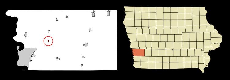
McClelland is a city in Pottawattamie County, Iowa, United States. The population was 151 at the 2010 census.
Contents
Map of McClelland, IA 51548, USA
Geography
McClelland is located at 41°19′45″N 95°41′03″W (41.329145, -95.684056).
According to the United States Census Bureau, the city has a total area of 0.17 square miles (0.44 km2), all of it land.
2010 census
As of the census of 2010, there were 151 people, 54 households, and 45 families residing in the city. The population density was 888.2 inhabitants per square mile (342.9/km2). There were 56 housing units at an average density of 329.4 per square mile (127.2/km2). The racial makeup of the city was 94.0% White, 1.3% African American, 0.7% from other races, and 4.0% from two or more races. Hispanic or Latino of any race were 2.0% of the population.
There were 54 households of which 38.9% had children under the age of 18 living with them, 70.4% were married couples living together, 9.3% had a female householder with no husband present, 3.7% had a male householder with no wife present, and 16.7% were non-families. 13.0% of all households were made up of individuals and 3.7% had someone living alone who was 65 years of age or older. The average household size was 2.80 and the average family size was 3.02.
The median age in the city was 36.5 years. 28.5% of residents were under the age of 18; 7.9% were between the ages of 18 and 24; 28.4% were from 25 to 44; 28.5% were from 45 to 64; and 6.6% were 65 years of age or older. The gender makeup of the city was 45.7% male and 54.3% female.
2000 census
As of the census of 2000, there were 129 people, 50 households, and 35 families residing in the city. The population density was 803.7 people per square mile (311.3/km2). There were 51 housing units at an average density of 317.7 per square mile (123.1/km2). The racial makeup of the city was 97.67% White, and 2.33% from two or more races. Hispanic or Latino of any race were 0.78% of the population.
There were 50 households out of which 34.0% had children under the age of 18 living with them, 56.0% were married couples living together, 6.0% had a female householder with no husband present, and 30.0% were non-families. 18.0% of all households were made up of individuals and none had someone living alone who was 65 years of age or older. The average household size was 2.58 and the average family size was 2.89.
In the city, the population was spread out with 26.4% under the age of 18, 5.4% from 18 to 24, 35.7% from 25 to 44, 24.0% from 45 to 64, and 8.5% who were 65 years of age or older. The median age was 38 years. For every 100 females there were 101.6 males. For every 100 females age 18 and over, there were 115.9 males.
The median income for a household in the city was $41,625, and the median income for a family was $41,875. Males had a median income of $29,531 versus $28,438 for females. The per capita income for the city was $22,155. There were no families and 2.3% of the population living below the poverty line, including no under eighteens and none of those over 64.