
Country United States GNIS feature ID 122460 Local time Thursday 7:25 AM | Time zone Central (CST) (UTC-6) Elevation 155 m Area code Area code 205 | |
 | ||
Weather -1°C, Wind SW at 3 km/h, 74% Humidity | ||
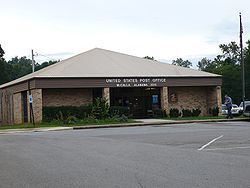
Mc Calla (often shortened to McCalla) is an unincorporated community in Jefferson and Tuscaloosa counties, Alabama, United States, southwest of Bessemer and the geographic terminus of the Appalachian Mountains.
Contents
Map of McCalla, AL 35111, USA
The community is named for Richard Calvin McCalla, a well known civil engineer, who served as chief engineer of several railroads throughout the South, including the Alabama and Chattanooga, the Tuscaloosa and Northern and the Knoxville and Ohio. He also served as surveyor of many of the rivers throughout the South.
Recreation
Tannehill State Park features a 19th-century blast furnace, the Iron and Steel Museum of Alabama, various historical buildings, rustic cabins, and a campground. The park also has a slave cemetery. The park is home to several festivals throughout the year, including the Southern Appalachian Dulcimer Festival, the Down Home Psaltery Festival, archery tournaments, a civil war reenactment, and other events.
Schools
The McCalla area is served by McAdory Elementary, McAdory Middle and McAdory High schools.