
Country Philippines Barangays Area 399.6 km² Province Eastern Samar | Established May 1, 1951 Time zone PST (UTC+8) Local time Thursday 9:12 AM | |
 | ||
Region Eastern Visayas (Region VIII) Congr. district Lone district of E. Samar Weather 27°C, Wind NE at 13 km/h, 82% Humidity | ||
Maydolong eastern samar where the sun rises early
Maydolong is a fourth class municipality in the province of Eastern Samar, Philippines. According to the 2015 census, it has a population of 14,743 people.
Contents
- Maydolong eastern samar where the sun rises early
- Map of Maydolong Eastern Samar Philippines
- Maydolong eastern samar
- Etymology
- History
- Barangays
- Demographics
- References
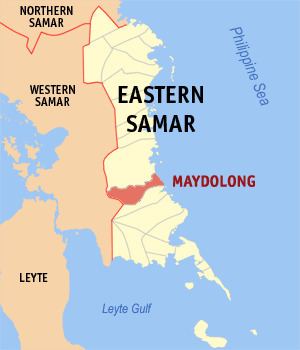
Map of Maydolong, Eastern Samar, Philippines
Maydolong eastern samar
Etymology
There are two stories about the naming of Maydolong. Officially accepted by the Sangguniang Bayan is the story of a fisherman who used to travel to the village of Matnog. Because they needed to rest from their travel along the east coast of Samar, these fisherman used to say "Matnog it Dolong" which means "the bow must point to Matnog" in the local dialect. This saying got shortened to Maydolong, which eventually became the name of the village.
History
Maydolong was created from the barrios of Maydolong, Balogo, Maybocog, Omawas, Tagaslian, Kampakirit, Suribao, Mayburak, Kanmanungdong, Malobago, Tabi, Maytigbao, and Kanluterio, May 1, 1951. These barrios used to belong to the provincial capital Borongan, Eastern Samar.
Barangays
Maydolong is politically subdivided into 20 barangays.
Demographics
The population of Maydolong in the 2015 census was 14,743 people, with a density of 37 inhabitants per square kilometre or 96 inhabitants per square mile.