
PIN 744204 | Time zone IST (UTC+5:30) Vehicle registration AN 01 | |
 | ||
District | ||
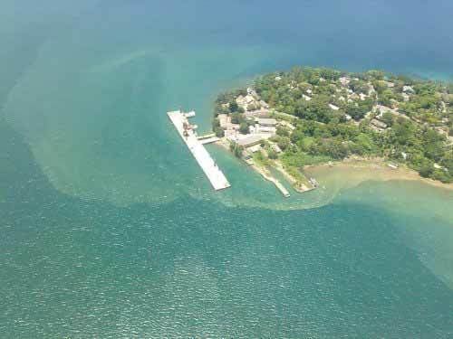
Street view mayabunder andaman and nicobar islands
Mayabunder is a town and a county (tehsil) in the northern part of Middle Andaman Island, Andaman Archipelago, India. The name is also spelled Maya Bunder or Maya Bandar. As of 2001, the county had 23.912 inhabitants, of which 3182 were in the town. It was settled in the British colonial period by immigrants from Myanmar and Bangladesh and ex-convicts.
Contents
- Street view mayabunder andaman and nicobar islands
- Map of Mayabunder Andaman and Nicobar Islands 744204
- Geography
- Economy and facilities
- Villages
- References
Map of Mayabunder, Andaman and Nicobar Islands 744204
Administratively, Mayabunder is the headquarters of the North and Middle Andaman district, which is part of the Andaman and Nicobar Islands territory.
Geography
Mayabunder is linked with Port Blair by the Andaman Trunk Road (242 km) and by ferry (136 km).
Economy and facilities
Mayabunder is a waystation for several tourist attractions, such as mangrove lined tidal creeks, the beach at Avis Island (30 minutes by boat), and Karamatang Beach (13 km), a sea turtle nesting ground. Port Blair and Mayabunder are the only ports that can harbour passenger ships from mainland India.
Mayabunder has a public college named Mahatma Gandhi Government College.
On 24 December 2012, Indian Coast Guard Station Mayabunder, the first CG Station in the North Andaman Islands was commissioned by the Defence Secretary, Shri Shashi Kant Sharma.
Villages
According to the 2001 census, Mayabunder county includes the following villages: