
Location Luzon Strait Population uninhabited Archipelago Batanes | Region Cagayan Valley Area 120 ha Province Batanes | |
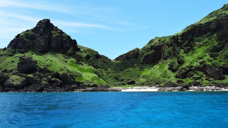 | ||
Mavulis Island is the northernmost of the Batanes Islands and the northernmost island in the Philippines. It is part of the province of Batanes.
Contents
Map of Y'Ami Island, Itbayat
The island is full of vegetation of mango and palm, and is part of the Luzon Volcanic Arc. The island is uninhabited according to the 2004 Philippine census.
Alternative names
Older Batan natives was also called the island Dihami, meaning "north" in Ivatan. By some members of the Spanish colonial government it was called Diami, and it is known as Yami or Y'Ami on most American Colonial Era maps of the Philippines.
The latter should not be confused with the aboriginal Yami of Taiwan that live on islands farther north beyond Philippine territorial limits, but are geographically, culturally and linguistically related to the Ivatan people.