
Country United States Area code(s) 864 Elevation 290 m Population 24,525 (2013) | Time zone Eastern (EST) (UTC-5) FIPS code 45-45115 Zip code 29662 Local time Wednesday 11:01 AM | |
 | ||
Weather 1°C, Wind NW at 13 km/h, 25% Humidity | ||
Us276 mauldin south carolina
Mauldin is a city in Greenville County, South Carolina, United States. The population was 15,224 at the 2000 census, 22,889 at the 2010 census, and an estimated 25,135 in 2015. It is a principal city of the Greenville-Anderson-Mauldin Metropolitan Statistical Area.
Contents
- Us276 mauldin south carolina
- Map of Mauldin SC USA
- Geography
- History
- Demographics
- Economy
- School
- Notable people
- References
Map of Mauldin, SC, USA
Geography
Mauldin is located south of the center of Greenville County, between the city of Greenville to the northwest and Simpsonville to the southeast. According to the United States Census Bureau, the city has a total area of 10.0 square miles (25.9 km2), of which 0.04 square miles (0.1 km2), or 0.46%, are water.
U.S. Route 276 (Main Street) passes through the center of Mauldin, leading northwest 8 miles (13 km) to the center of Greenville and southeast 5 miles (8 km) to Simpsonville. Interstate 385 runs through the eastern side of Mauldin, leading north to Interstate 85 on the east side of Greenville. I-385 connects with Interstate 185 on the southern edge of Mauldin, and I-185 continues west and northwest 13 miles (21 km) to join I-85 on the southwest side of Greenville. From its interchange with I-185, I-385 leads southeast 30 miles (48 km) to Interstate 26 near Clinton.
History
Benjamin Griffith was awarded the first land grant in what is now called Mauldin in 1784. The name of Mauldin was given to the town almost accidentally in 1820 thanks to South Carolina's lieutenant governor, W. L. Mauldin. The train station was called "Mauldin" because the lieutenant governor had assisted in getting the Greenville Laurens Railroad Company to come through the village. Over time, the entire area took the name of Mauldin.
During the Civil War, many of Mauldin's citizens left to fight, and the city virtually dried up. It never completely recovered until after World War II when the community was incorporated as a town (1960).
Demographics
As of the census of 2000, there were 15,224 people, 6,131 households, and 4,242 families residing in the city. The population density was 1,767.1 people per square mile (681.9/km²). There were 6,500 housing units at an average density of 754.5 per square mile (291.1/km²). The racial makeup of the city was 74.25% White, 20.82% African American, 0.30% Native American, 2.24% Asian, 0.11% Pacific Islander, 0.98% from other races, and 1.31% from two or more races. Hispanic or Latino of any race were 2.73% of the population.
There were 6,131 households out of which 33.9% had children under the age of 18 living with them, 55.8% were married couples living together, 10.4% had a female householder with no husband present and 30.8% were non-families. 26.0% of all households were made up of individuals and 6.2% had someone living alone who was 65 years of age or older. The average household size was 2.46 and the average family size was 2.97.
In the city, the population was spread out with 25.0% under the age of 18, 8.1% from 18 to 24, 33.5% from 25 to 44, 24.1% from 45 to 64, and 9.3% who were 65 years of age or older. The median age was 35 years. For every 100 females there were 93.2 males. For every 100 females age 18 and over, there were 91.0 males.
The median income for a household in the city was $51,657, and the median income for a family was $61,817. Males had a median income of $41,047 versus $29,985 for females. The per capita income for the city was $24,750. About 3.2% of families and 4.4% of the population were below the poverty line, including 6.7% of those under age 18 and 9.2% of those age 65 or over.
Economy
The supermarket chain BI-LO once had its headquarters in Mauldin.
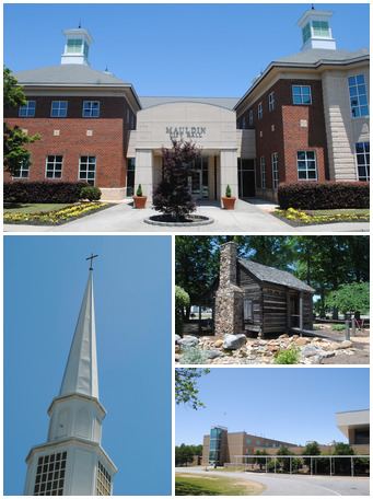
School
Greenville County School District operates public schools. The only high school is Mauldin High School.