
Country India District Rewa PIN 486331 Elevation 313 m Local time Wednesday 8:12 PM | State Madhya Pradesh Time zone IST (UTC+5:30) Vehicle registration MP Population 26,420 (2001) ISO 3166 code ISO 3166-2:IN | |
 | ||
Weather 21°C, Wind N at 3 km/h, 33% Humidity | ||
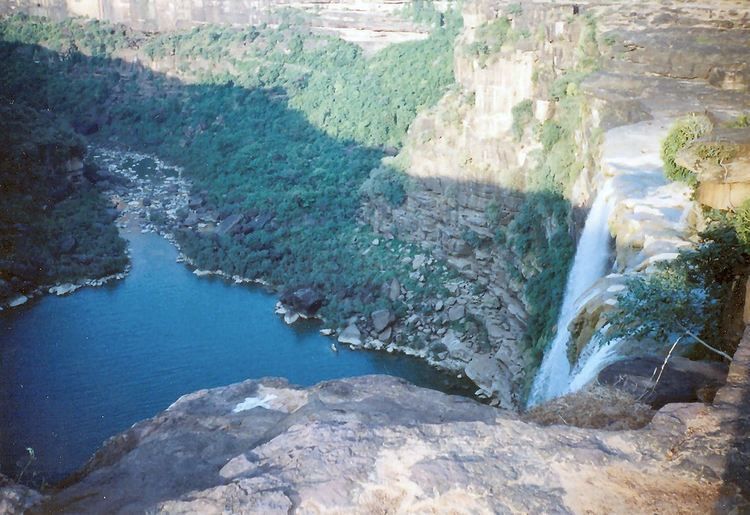
Mauganj is a small town and a nagar panchayat in Rewa district in the Indian state of Madhya Pradesh. Bagheli is the regional language of Mauganj. The place is famous for waterfalls.
Contents
Map of Maunganj, Madhya Pradesh 486331
Geography
Mauganj is located at 24.68°N 81.88°E / 24.68; 81.88. It has an average elevation of 313 metres (1026 feet). Mauganj is 65 km from Rewa, and villages Panni, Dhera, Barahata,Pakara Pande, Khatkhri, Padar, Nandanpur.
Some sites of religious significance around Mauganj are:
Tourist places-
Demographics
As of 2001 India census, Mauganj had a population of 22,989. Males constitute 52% of the population and females 48%. Mauganj has an average literacy rate of 52%, lower than the national average of 59.5%: male literacy is 63%, and female literacy is 41%. In Mauganj, 18% of the population is under 6 years of age.