
Prominence 278 ft (85 m) Topo map USGS Tenaya Lake Elevation 3,329 m | Parent peak Echo Ridge | |
 | ||
Similar Cathedral Peak, Tenaya Peak, Mount Conness, Fairview Dome, Echo Peak | ||
Matthes crest downclimb 08 14 2015
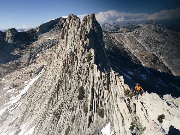
Matthes Crest is an approximately mile-long fin of rock with two summits separated by a deep notch. It is a part of the Cathedral Range, which is a mountain range in the south-central portion of Yosemite National Park. The range is part of the Sierra Nevada.
Contents
- Matthes crest downclimb 08 14 2015
- Map of Matthes Crest California USA
- Matthes crest in under ten
- History and GeologyEdit
- ClimbingEdit
- References
Map of Matthes Crest, California, USA
Matthes crest in under ten
History and GeologyEdit
Matthes crest is named for François E. Matthes, a cartographer and author who described the geology in the region where Matthes Crest lies. It was originally named "Echo Ridge" due to its proximity to the Echo Peaks. Matthes crest arose as a nunatak in the glacial field which covered Tuolumne during the last ice age.
ClimbingEdit
The first known ascent of Matthes Crest was by Jules Eichorn, Glen Dawson, and Walter Brem on June 16, 1931. Climbing Matthes Crest by traversing the ridge from south to north is a popular alpine climbing activity today.