
 | ||
Similar Hatcher Pass, Exit Glacier, Portage Glacier, Wrangell–St Elias National, Worthington Glacier | ||
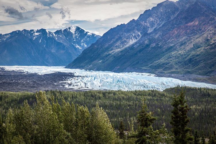
Alaska 2016 road trip to denali national park matanuska glacier and other places
Matanuska Glacier is a valley glacier in the US state of Alaska. At 27 miles (43 km) long by 4 miles (6.4 km) wide, it is the largest glacier accessible by car in the United States. Its terminus feeds the Matanuska River. It lies near the Glenn Highway about 100 miles (160 km) north-east of Anchorage. Matanuska Glacier flows about 1 foot (30 cm) per day. Due to ablation of the lower glacier, as of 2007, the location of the glacier terminus changed little over the previous three decades.
Contents
- Alaska 2016 road trip to denali national park matanuska glacier and other places
- Map of Matanuska Glacier Alaska USA
- Matanuska glacier alaska
- References
Map of Matanuska Glacier, Alaska, USA
The glacier is the eponym of the Alaska Marine Highway ferry M/V Matanuska.
Matanuska glacier alaska
References
Matanuska Glacier Wikipedia(Text) CC BY-SA