
Country New Zealand | ||
 | ||
The Matakitaki River is located in the north of New Zealand's South Island. An upper tributary of the Buller River, it flows north and west for 65 kilometres from its source north of the Lewis Pass, joining the Buller at Murchison. It has one major tributary, the Glenroy River.
Contents
- Map of Matakitaki River Tasman District New Zealand
- Whitewater recreation
- Trout fishing
- Hydroelectric power
- References
Map of Matakitaki River, Tasman District, New Zealand
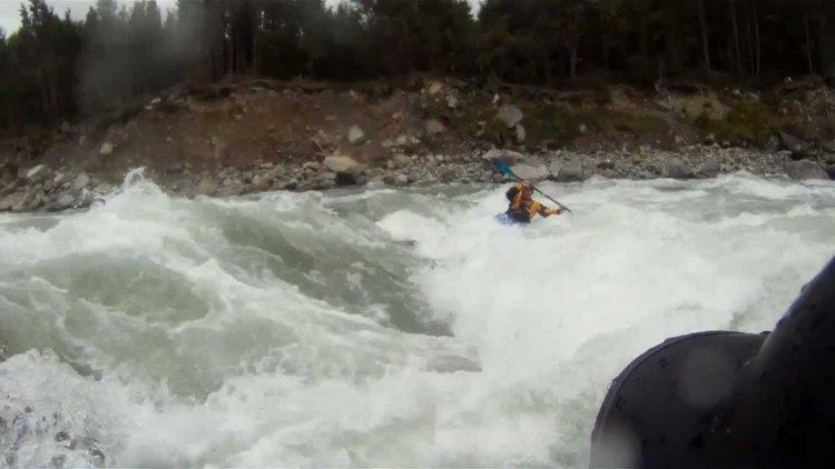
Whitewater recreation
The river has two excellent whitewater sections on it, and they are frequently paddled. The "Middle Matakitaki" section is about 10 km up the valley from Murchison, and is Grade/Class 2+, with some excellent play spots. The "Lower Matakitaki" section is a short distance up the river from Murchison, and is a short technical run pushing Grade/Class 3+ at medium flows, Grade/Class 4 at higher flows.
The Matakitaki River and tributaries are known for gold mining, both historically and today. Alluvial gold is regarded as having a high purity and is often found in the coarse form. Many river flats are subject to mining, including two dredging operations situated within the riverbed within the "Lower" and "Middle" sections.
Trout fishing
It is an extremely important fishery and highly regarded not only for the numbers caught, but also as a trophy River.
Hydroelectric power
Network Tasman have proposed a 30MW hydroelectric power station for the river. Whitewater NZ say it will interfere with the popular Middle Matakitaki whitewater run. Network Tasman announced that plans to investigate the river for hydro development are on hold due to economic conditions.