
Existed: by 1929 – present Counties: Barnstable | Length 5.94 km | |
 | ||
County Barnstable County, Massachusetts | ||
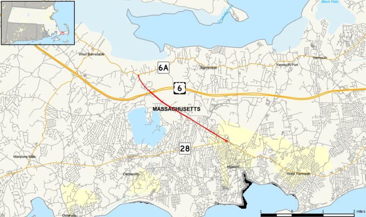
Route 132 is a state highway in the town of Barnstable, Massachusetts, part of Cape Cod. The entire length of the highway is also locally signed as part of Iyannough Road. Route 132 is the main link between greater Barnstable and the village of Hyannis, in fact, all of Route 132 lies within the Barnstable city limits, and connects Routes 28 and 6A via an almost straight northwest-southeast course.
Contents
Map of MA-132, Barnstable, MA 02630, USA
Route description
The southern terminus is at the Airport Rotary in Hyannis, at the intersection of Route 28. Iyanough Road itself begins further east on Route 28 at the Barnstable/Yarmouth border. The southernmost mile contains an immense number of malls and other large shopping centers along the route, such as the Christmas Tree Shops Plaza, Cape Cod Mall, the Capetown (K-Mart) Plaza, the Independence Plaza, and the Festival In Hyannis shopping center. Other restaurants, hotels, car dealerships, and strip malls dot the road densely until the intersection with Phinney's Lane. At Mile 3.0, it crosses underneath Route 6 at Exit 6 (mile 68 of the freeway). Cape Cod's only freeway service plaza is at this intersection. North of the intersection is Cape Cod Community College. The northern terminus of Route 132 is at Route 6A in the village of West Barnstable.
Traffic
Route 132 is notorious for its heavy traffic, especially during summer months. Originally 2 lanes on its entire length when first built, development has necessitated about half of the road's length to be widened to 4 lanes, with another stretch (between Phinney's Lane and US 6) constructed as a divided highway. Part of the original Route 132 was bypassed around Phinney's Lane in the 1960s to straighten out the road and keep traffic moving at a reasonable pace. Locally, the old section is simply known as "Old Route 132," and is officially designated as part of Attucks Lane by the city of Barnstable. The old road grade is on the right and it currently being used as a staging area for construction equipment.
Major intersections
The entire route is in Barnstable County.