
Area 0 acres (0 ha) NRHP Reference # 73001922 Added to NRHP 25 June 1973 | Built 1883 Opened 1883 | |
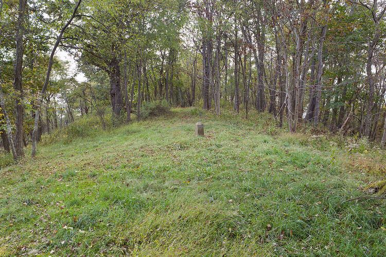 | ||
Location 2.25 mi (3.62 km) northeast of Pentress on County Route 39, near Pentress, West Virginia | ||
Mason and Dixon Survey Terminal Point is a historic marker located near Pentress, West Virginia, United States. Located on the boundary between Monongalia County, West Virginia and Greene County, Pennsylvania, it identifies the terminal station established by Charles Mason and Jeremiah Dixon on Brown's Hill on October 19, 1767. The stone placed on Brown's Hill in 1883 in the mound of 1767, marks the westernmost point reached by Mason and Dixon in delineating the common boundaries of Pennsylvania, Maryland, Delaware, and Virginia (now West Virginia), and known as the Mason–Dixon line.
It was listed on the National Register of Historic Places in 1973.
References
Mason and Dixon Survey Terminal Point Wikipedia(Text) CC BY-SA