
Topo map USGS Lorane Prominence 1,023 m | Elevation 1,249 m | |
 | ||
Easiest route trail from Mary's Peak Road Similar Saddle Mountain, Mount Hebo, Mount Jefferson, Trask Mountain, Mount Hood | ||
My favorite places marys peak near corvallis oregon
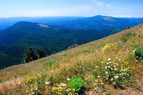
Marys Peak (formerly Mary's Peak and sometimes still spelled this way) is a mountain in Benton County, Oregon, United States, just southwest of Philomath. It is the highest peak in the Oregon Coast Range. It is also the highest point in Benton County, and ranks eleventh in the state for prominence.
Contents
- My favorite places marys peak near corvallis oregon
- Map of Marys Peak Oregon 97370 USA
- Marys peak oregon coast range
- References
Map of Marys Peak, Oregon 97370, USA
On a clear day at the top of the peak, facing east, northeast, and southeast, one can see the cities and suburbs of the Willamette Valley, as well as the Cascade Range. To the west, the Pacific Ocean is visible on clear days.
The road to the peak now remains open in the winter. During the 2010–2011 winter, the Forest Service announced that it will leave the gates open to facilitate travel to the summit. The road will not be maintained, so a lifted 4x4 or four wheel chains are required for motor access during the winter months.