
Existed: 1938 – present Counties: Somerset Constructed 1938 | Length 3.99 km | |
 | ||
West end: Crab Island Road in Oriole | ||
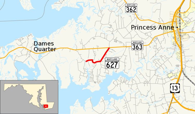
Maryland Route 627 (MD 627) is a state highway in the U.S. state of Maryland. Known as Oriole Road, the state highway runs 2.48 miles (3.99 km) from the intersection of Oriole Back Road and Crab Island Road in Oriole east to MD 363 near Venton. MD 627 was constructed and assigned in the mid-1930s.
Contents
Map of MD-627, Princess Anne, MD 21853, USA
Route description
MD 627 begins at the intersection of Crab Island Road and Oriole Back Road in the village of Oriole. Crab Island Road heads south toward the Manokin River, while Oriole Back Road heads northwest toward an intersection with MD 363 at Monie. MD 627 heads east through the village and makes a sharp turn to the south where Jerusalem Road heads north. The state highway curves east through forest. After passing Locust Point Road, which leads south to the Manokin Historic District, MD 627 veers northeast through farmland to its eastern terminus at MD 363 (Deal Island Road).
History
Oriole Road was reconstructed by the Maryland State Roads Commission in 1934 when they took over maintenance of highways in Somerset County. The highway was brought into the state system and designated MD 627 in 1938.
Junction list
The entire route is in Somerset County.