
Existed: 1935 – present Length 6.82 km | Constructed 1935 | |
 | ||
Touristroutes: Harriet Tubman Underground Railroad Byway | ||
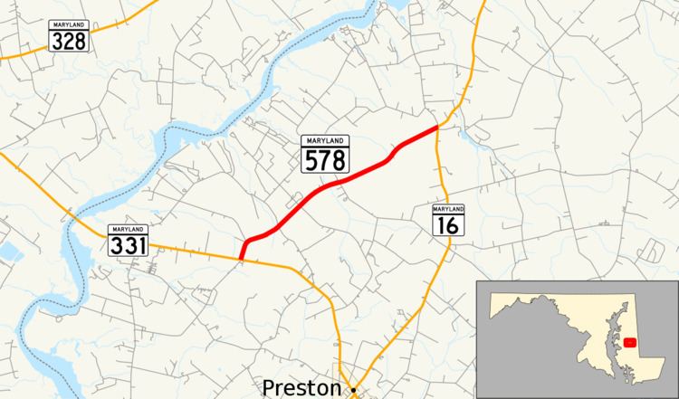
Maryland Route 578 (MD 578) is a state highway in the U.S. state of Maryland. Known as Bethlehem Road, the state highway runs 4.24 miles (6.82 km) from MD 331 at Bethlehem east to MD 16 at Harmony. The first segment of MD 578 was completed in the mid-1930s; the remainder was built in the early 1940s.
Contents
Map of MD-578, Preston, MD 21655, USA
Route description
MD 578 begins at an intersection with MD 331 (Dover Bridge Road) in Bethlehem. Bethlehem Road continues south as a county highway. MD 578 heads northeast as a two-lane road through farmland. After passing Newton Road, the state highway crosses Hog Creek. MD 578 meets its eastern terminus at MD 16 (Harmony Road) in the unincorporated village of Harmony.
History
MD 578 was paved by 1935 from Bethlehem to Newton Road. The remainder of the highway to Harmony, including the bridge over Hog Creek, was completed in 1941.
Junction list
The entire route is in Caroline County.