
Existed: 1933 – present Length 10.83 km | Constructed 1933 | |
 | ||
County | ||
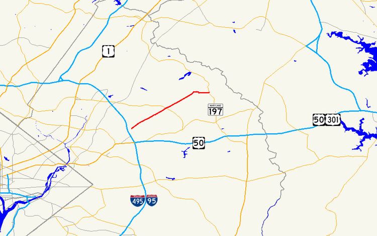
Maryland Route 564 (MD 564) is a state highway in the U.S. state of Maryland. Known for most of its length as Lanham Severn Road, the state highway runs 6.73 miles (10.83 km) from MD 450 in Lanham east to a dead end near a connection to MD 197 in Bowie. MD 564 was constructed from Lanham to Old Town Bowie in the mid-1930s. In the early 1990s, the highway was extended east over part of MD 197 when that highway was relocated through Bowie.
Contents
Map of MD-564, Maryland, USA
Route description
MD 564 begins at a partial interchange with MD 450 (Annapolis Road) in Lanham. There is no access from westbound MD 450 to eastbound MD 564 or from westbound MD 564 to eastbound MD 450. Eastbound MD 564 exits from eastbound MD 450, passes under MD 450, and meets westbound MD 564 at an intersection where heading straight leads to Cipriano Road. The two directions of MD 564 come together as Lanham Severn Road, a two-lane road heading northeast paralleling the Amtrak Northeast Corridor and MARC's Penn Line at a distance. The state highway crosses Baldhill Branch and passes through the unincorporated community of Seabrook, where the road intersects Seabrook Road and passes the Seabrook MARC station. After passing through a commercial area in Seabrook, MD 564 passes several industrial properties on the railroad side of the highway. The state highway enters Glenn Dale, where the highway temporarily expands to a four-lane divided highway for intersections with Glenn Dale Road (unsigned MD 953A) and MD 193 (Glenn Dale Boulevard).
MD 564 continues northeast, passing Hillmeade Road and Springfield Road before entering the Old Town Bowie section of the city of Bowie, where the highway's name changes to 9th Street. At Chestnut Avenue, which is unsigned MD 564A, the state highway assumes that street's name and turns south to cross the Amtrak Northeast Corridor just north of its junction with CSX's Popes Creek Subdivision. MD 564 turns east onto 11th Street, which heads west toward the railroad wye as unsigned MD 564C. After passing Race Track Road, which heads east toward an intersection with MD 197 (Laurel–Bowie Road), MD 564 curves south and reaches its southern terminus at the entrance to a farm adjacent to the Washington, Baltimore and Annapolis Trail's crossing of MD 197.
History
MD 564 was constructed as a concrete road from U.S. Route 50 (now MD 450) in Lanham to Seabrook Road in Seabrook starting in 1933. The remainder of the highway was built as a gravel road from Seabrook to its original eastern terminus at MD 197 (now Chestnut Street) in Bowie in 1934. Both segments that parallel what was then the Pennsylvania Railroad were completed in 1934. The portion of MD 564 east of Chestnut Street was built as part of MD 197 in 1929 and 1930. MD 564 was widened to 22 feet (6.7 m) along its entire length between 1949 and 1952. The route was expanded to a divided highway on either side of the MD 193 intersection in 1985 when Glenn Dale Boulevard was completed across the Amtrak Northeast Corridor. MD 564's partial interchange with MD 450 was built shortly after the latter highway's bridge across the railroad tracks was expanded in 1989. MD 564 was extended east to its present terminus when MD 197 was removed from Old Town Bowie to its present course to the east in 1991. Chestnut Street originally crossed the railroad north–south in line with the street grid of Old Town Bowie. MD 564's modern bridge across the Amtrak Northeast Corridor, which is perpendicular to the railroad, was completed in 1994.
Junction list
The entire route is in Prince George's County.
Auxiliary routes
MD 564 has three unsigned auxiliary routes in Bowie.