
Existed: 1956 – present Length 2.04 km | Counties: St. Mary's Constructed 1956 | |
 | ||
West end: MD 5 in Park Hall Estates East end: MD 235 near Park Hall Estates County | ||
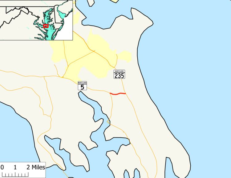
Maryland Route 489 (MD 489) is a state highway in the U.S. state of Maryland. Known as Park Hall Road, the state highway runs 1.27 miles (2.04 km) from MD 5 east to MD 235 within Park Hall Estates in southern St. Mary's County. MD 489, which serves as a connector between MD 5 and MD 235 south of Lexington Park, was assigned to Park Hall Road in 1956.
Contents
Map of MD-489, Park Hall, MD 20667, USA
Route description
MD 489 begins at an intersection with MD 5 (Point Lookout Road) in the unincorporated community of Park Hall Estates between St. Mary's City and Great Mills. The state highway heads east as a two-land road through a mix of farmland and forest. MD 489 reaches its eastern terminus at MD 235 (Three Notch Road) between Ridge and Lexington Park.
History
MD 489 was assigned to Park Hall Road in 1956. Aside from repaving, the state highway has changed very little since then.
Junction list
The entire route is in Park Hall Estates, St. Mary's County.