
Existed: 1933 – present North end: MD 242 in Dynard Length 6.04 km | Counties: St. Mary's Constructed 1933 | |
 | ||
County | ||
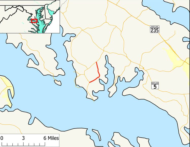
Maryland Route 470 (MD 470) is a state highway in the U.S. state of Maryland. Known as Oakley Road, the state highway runs north 3.75 miles (6.04 km) between intersections with MD 242 in Avenue and Dynard. MD 470 loops through Oakley in western St. Mary's County. The state highway was constructed in the early 1930s.
Contents
Map of MD-470, Avenue, MD 20609, USA
Route description
MD 470 begins at an intersection with MD 242 (Colton Point Road) in the community of Avenue. The state highway immediately intersects Abell Road, which heads east toward the community of Abell. MD 470 heads northeast as an 18-foot (5.5 m) wide two-lane road through a mix of farmland and forest. The state highway crosses Canoe Neck Creek before curving north through the hamlet of Oakley. The highway intersects Burch Road, which provides access to the historic home The River View, before widening to 20 feet (6.1 m). MD 470 passes All Saints Episcopal Church, then crosses Tomakokin Creek and reaches its northern terminus at MD 242 (Colton Point Road) near the hamlet of Dynard.
History
MD 470 was constructed as a gravel road in three sections in the early 1930s. The first section was constructed from Avenue to just north of Canoe Neck Creek starting in 1930. That first section and the second section from Canoe Neck Creek through Oakley to south of Tomakokin Creek were completed by 1933. The final section north to Dynard was started in 1934 and completed in 1935. Aside from widening and paving, MD 470 has changed very little from when it was first constructed.
Junction list
The entire route is in St. Mary's County.