
Existed: 1930 – present Length 13.82 km | South end: MD 304 near Bridgetown Counties: Queen Anne's Constructed 1930 | |
 | ||
County | ||
Maryland Route 405 (MD 405) is a state highway in the U.S. state of Maryland. Known as Price Station Road, the state highway runs 8.59 miles (13.82 km) from MD 304 near Bridgetown north to MD 19 near Church Hill. MD 405 connects Church Hill and Bridgetown with the central Queen Anne's County community of Price, where the highway intersects U.S. Route 301 (US 301). The state highway was constructed from Price to south of Roe in the early 1930s and from Price to Church Hill in the mid-1930s. MD 405 was extended from Roe to Bridgetown in Caroline County in the early 1940s. The Bridgetown end was truncated when MD 304 was extended east to Bridgetown in the mid-1960s.
Contents
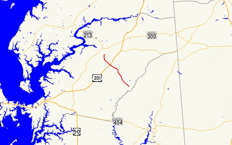
Map of MD-405, Maryland, USA
Route description
MD 405 begins at an intersection with MD 304 (Ruthsburg Road) west of Bridgetown. The state highway heads northwest through farmland as two-lane Prince Station Road, passing Shawn Road before intersecting Hope Road and Roe Ingleside Road in the hamlet of Roe. After crossing German Branch and passing Roseville Memorial Cemetery, MD 405 reaches the hamlet of Price, where it crosses the Centreville Branch of the Northern Line of the Maryland and Delaware Railroad at grade. Immediately beyond the railroad track, the state highway intersects the dual carriageways of US 301 (Blue Star Memorial Highway), which are separated by a wide median. MD 405 curves north at Flat Iron Square Road and bridges Southeast Branch before reaching its northern terminus at MD 19 (Roberts Station Road) south of Church Hill.
History
The first section of MD 405 was paved from the railroad track south a short distance through Price by 1930. That highway was extended in two sections that were started in 1930: the highway between Roe and Shawn Road south of Roe was completed in 1932, while the segment between Roe and the existing road at Price was completed in 1933. MD 405 from MD 19 south to Flat Iron Square Road was also completed in 1933. The gap between Price and Church Hill was filled in 1935. The highway from Shawn Road south and then east along present day MD 304 to Bridgetown was constructed between 1940 and 1942. MD 405's southern terminus was moved to its present location when MD 304 was extended east from Ruthsburg to Bridgetown in 1964.
Junction list
The entire route is in Queen Anne's County.