
Existed: 1927 – present Constructed 1927 | Length 2.48 km | |
 | ||
Counties Anne Arundel County, Maryland, Balti | ||
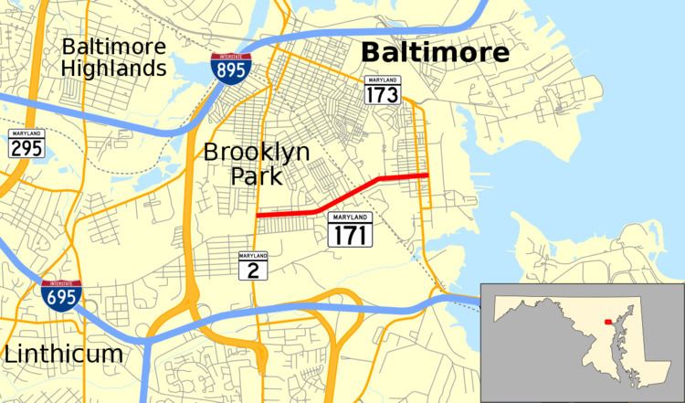
Maryland Route 171 (MD 171) is a state highway in the U.S. state of Maryland. Known as Church Street, the state highway runs 1.54 miles (2.48 km) from MD 2 in Brooklyn Park east to MD 173 in the Curtis Bay neighborhood of Baltimore. MD 171 was constructed in the mid-1920s.
Contents
Map of MD-171, Maryland, USA
Route description
MD 171 begins at an intersection with MD 2 (Governor Ritchie Highway) in Brooklyn Park. The state highway heads east as a two-lane street through a densely populated residential neighborhood. After passing 6th Street, MD 171 enters the city of Baltimore. After passing through the Curtis Bay neighborhood, the state highway meets its eastern terminus on the edge of the Curtis Bay Industrial Area at MD 173, which is formed by a one-way pair, Pennington Avenue southbound and Curtis Avenue northbound.
History
Church Street was laid out through what was then entirely Anne Arundel County by 1907. The Anne Arundel County portion of MD 171 was paved as a 15-foot (4.6 m) wide concrete road in 1926. It is not clear when the city part of the highway was paved, but the city portion was designated a state highway by 1946.