
Existed: 1927 – present Counties: Harford Constructed 1927 | Length 8.66 km | |
 | ||
Touristroutes: Lower Susquehanna Scenic Byway South end: MD 155 in Hopewell Village | ||
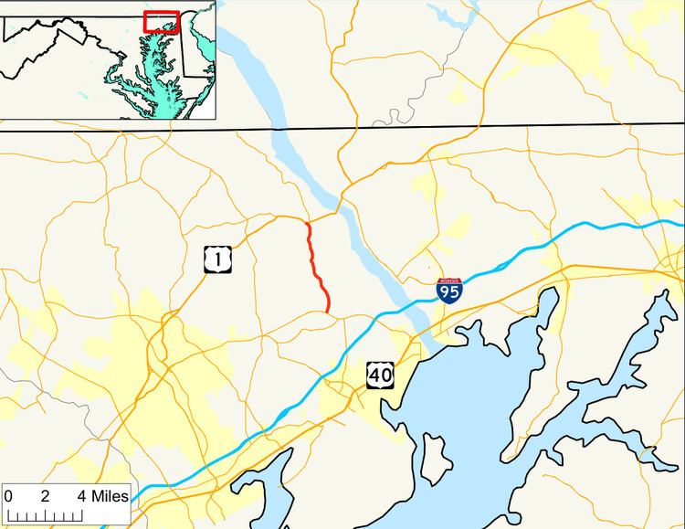
Maryland Route 161 (MD 161) is a state highway in the U.S. state of Maryland. The state highway runs 5.38 miles (8.66 km) from MD 155 in Hopewell Village north to U.S. Route 1 (US 1) in Darlington. MD 161 connects Havre de Grace with Susquehanna State Park and northeastern Harford County. The state highway was mostly constructed in the late 1920s and early 1930s.
Contents
Map of MD-161, Maryland, USA
Route description
MD 161 begins at an intersection with MD 155 (Level Road) in Hopewell Village, which is also known as Level. The state highway heads north as two-lane Darlington Road through farmland. A short distance north of MD 155, MD 161 intersects Rock Run Road, which heads northeast toward Susquehanna State Park. After passing through the Silver Houses Historic District, the state highway crosses Deer Creek. At Trappe Church Road, MD 161's name changes to Main Street and the highway passes through the village of Darlington, which is contained within its own historic district. At the north end of the village, the state highway meets the southern end of MD 623 (Castleton Road) and passes the Deer Creek Friends Meetinghouse before reaching its northern terminus at US 1 (Conowingo Road).
History
The first section of MD 161 to be improved was 1 mile (1.6 km) of macadam road from Shuresville Road in Darlington south to Price Road built by 1910. Two sections of macadam road were constructed in 1928. One segment was constructed from Shuresville Road in Darlington north to US 1. The other section was built from the modern intersection of MD 155 and MD 156 northwest to Hopewell Village, along the path of what is now MD 155. The next portion of MD 161 constructed was a concrete road from Level to Harmony Church Road in 1929 and 1930. The gap between Harmony Church Road and Price Road was filled with a concrete road between 1930 and 1932, a project that included a new bridge over Deer Creek.
Junction list
The entire route is in Harford County.