
Country Turkmenistan Area 87,150 km² | Capital Mary | |
 | ||
Points of interest Gonur Tepe, Mary Museum, Badhyz State Nature R, Tomb of Ahmed Sanjar, Gurbanguly Hajji Mosque | ||
Mary Region (Turkmen: Mary welaýaty, Мары велаяты) is one of the regions of Turkmenistan. It is located in the south-east of the country, bordering Afghanistan. Its capital is the city of Mary. Its area is 87,150 km2 (33,650 sq mi) and population 1,480,400 (2005 est.). The average population density is about 15 persons per square kilometer, but it reaches 150-200 per square kilometer in the most developed oases.
Contents
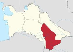
Map of Mary, Turkmenistan
In 2000, Mary Region accounted for 23% of Turkmenistan's population, 19% of the total number of employed, 26% of agricultural production (by value), and 21% of the country's total industrial production. The region's industries include natural gas extraction (the Iolotan gas field), electric power generation, textiles, carpet weaving, chemical and food industry. In 2001 it accounted for 74% of Turkmenistan's electricity generation 26% of natural gas extraction. According to other sources, Mary Province accounts for 81% of fertilizer production, 40% of textiles, 81% of leather, and 23% of footwear. Mary agriculture produces 31% of Turkmenistan's cotton fibres and 32% of its vegetable oil.
Agriculture in Mary Region is irrigated by the Karakum Canal, which runs east to west through the center of the province, and by the Murghab River, which runs south to north, entering the province from Afghanistan. While the northern portion of the province is within the Central Asian southern desert ecoregion, the southern portion of the province is characterized by a savanna of pistachio and desert sedges, classified as the Badkhiz-Karabil semi-desert by the World Wildlife Fund
Ancient Merv, designated a UNESCO World Heritage Site, is the main archeological attraction of Mary Province. This is one of the best preserved oasis cities on the ancient silk route.
The capital of Mary Region is the city of Mary, located at the intersection of Murghab River with the Karakum Canal. Other cities are Baýramaly (Russian: Байрам-Али), Ýolöten (Iolotan, Russian: Иолотань), and Serhetabat (Russian: Серхетабад, formerly Turkmen: Guşgy, Russian: Кушка) on the border with Afghanistan.
Districts
Mary Region is divided into 12 districts (etraplar; singular etrap) and two cities (il). Name changes since 1995 are shown in parentheses: