
Population 360 (2011) Sovereign state United Kingdom Local time Monday 7:11 PM | OS grid reference SK890434 | |
 | ||
Weather 11°C, Wind W at 11 km/h, 75% Humidity UK parliament constituency | ||
Marston is a village and civil parish in the South Kesteven district of Lincolnshire, England. The population of the civil parish at the 2011 census was 360. It lies 5 miles (8 km) north from Grantham, 8 miles (13 km) south-east from Newark, and 1.5 miles (2.4 km) north from the A1 near Long Bennington.
Map of Marston, UK
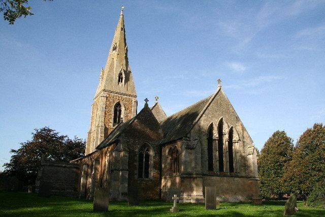
Marston Grade I listed Anglican parish church is dedicated to St Mary, and is of 12th-century origin, with an 1881-82 chancel by C. Kirk. Pevsner gives the date of the chancel as 1878, restored and partly rebuilt in Early English style. St Mary's holds monuments to members of the Thorold family.
Marston Hall is a Grade II* late 16th-century country house, with further alterations up to the 18th century. Pevsner records a 1962 "gothick" style garden gazebo, designed by John Partridge, with pinnacles by Christopher Blackie and murals by Barbara Jones.
The village has a church, a hall, the Old Barn Hotel, the Thorold Arms public house, a fishery, and the Marston Thorold Primary School. The school, still somewhat supported by the Dame Margaret Thorold Educational Foundation, is now Church of England voluntary aided. The building dates from 1861.