Canton Lunel Area 42.7 km² | Region Occitanie Intercommunality Pays de Lunel | |
 | ||
Marsillargues is a commune in the Hérault department in southern France.
Contents
- Map of Marsillargues France
- Geography
- Guillaume de Nogarets Castle
- Saint Sauveur Church
- Protestant Temple
- Personalities
- References
Map of Marsillargues, France
Its inhabitants are called Marsillarguois.
Geography
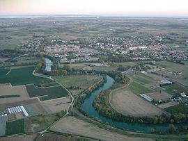
The city is situated on the Vidourle river, at mid distance of Montpellier and Nîmes. The commune lies on a vast plain, quite marshy in the south part, which is called Petite Camargue. The closest towns to Marsillargues are Lunel, Aimargues and Saint-Laurent-d'Aigouze.
Guillaume de Nogaret's Castle
The castle was founded in 1305 by Guillaume de Nogaret, who became Lord of Marsillargues, in reward of his services returned to Philip IV, King of France. From the feudal castle, only the basements, the large kitchens and the keep with its square tower remain.
Saint-Sauveur Church
The church was built in 1688 by Jacques Cubissol, and houses a remarkable oil painting on canvas "La Nativité" attributed to French painter Charles Errard.
Protestant Temple
A Temple was first built between 1574 and 1582. During the tragic period of the French Wars of Religion, it was damaged and then repaired in 1599, only to be totally destroyed in 1685 following the revocation of the Edict of Nantes. The Concordat of 1801 allowed a Protestant minister to be installed at Marsillargues in 1803. Ground was broken for a new Temple in 1806, and it was finished in 1818.
